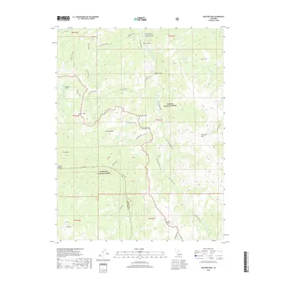
2018 Map of Disaster Peak
USGS Topo · Published 2018About this map
The Pacific Crest Trail winds through this high-elevation landscape along the border of Alpine and Tuolumne counties. The area is defined by its massive granite features and alpine hydrology, anchored by the namesake Disaster Peak and nearby Whitecliff Peak. Within the Toiyabe National Forest and Stanislaus National Forest, the terrain drops into significant drainage basins like White Canyon and Golden Canyon. High-country water features are prominent, including Asa Lake, Boulder Lake, and the tumbling Carson Falls along the East Fork Carson River. To the south, Seven Pines sits near the headwaters of the Clark Fork, while meadows such as Coyote Meadow and Iceberg Meadow provide rare level ground amidst the peaks. The map details a transition from the volcanic soils of the northern crest to the dramatic ridgelines of Stanislaus Peak and Red Peak.
Find a feature on this map
52 named features on this map. Tap any name to fly to it.
Don’t see what you’re looking for? This feature index may not catch every label — zoom into the map to look around manually.
Map Details
Editions of this 2018 Disaster Peak Map
This is the sole edition of this map. No revisions or reprints were ever made.
Other maps of this area

1889 · Markleeville
USGS Topo · 1:125,000

1891 · Markleeville
USGS Topo · 1:125,000

1893 · Markleeville
USGS Topo · 1:125,000

1896 · Dardanelles
USGS Topo · 1:125,000

1898 · Dardanelles
USGS Topo · 1:125,000

1948 · Walker Lake
USGS Topo · 1:250,000

1954 · Pickel Meadow
USGS Topo · 1:24,000

1954 · Lost Cannon Peak
USGS Topo · 1:24,000

1956 · Topaz Lake
USGS Topo · 1:62,500

1956 · Markleeville
USGS Topo · 1:62,500