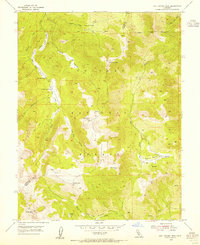
1954 Map of Lost Cannon Peak
USGS Topo · Published 1955About this map
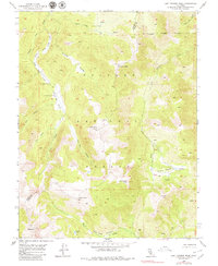
Toiyabe National Forest provides the backdrop for this mid-century topographic survey, where high-altitude drainages define the landscape. The map captures the remote character of the Alpine Co Mono Co boundary, a region where seasonal activity is centered around sites like Connells Cow Camp. Water is the primary architect of this terrain, with systems such as Lost Cannon Creek and Silver Creek carving through deep valleys.
Find a feature on this map
26 named features on this map. Tap any name to fly to it.
Don’t see what you’re looking for? This feature index may not catch every label — zoom into the map to look around manually.
Map Details
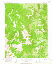
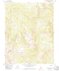
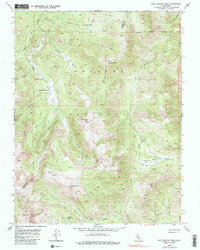
Editions of this 1954 Lost Cannon Peak Map
5 editions found
Other maps of this area

1889 · Markleeville
USGS Topo · 1:125,000

1891 · Markleeville
USGS Topo · 1:125,000

1891 · Wellington
USGS Topo · 1:125,000

1893 · Markleeville
USGS Topo · 1:125,000

1893 · Wellington
USGS Topo · 1:125,000

1896 · Dardanelles
USGS Topo · 1:125,000

1898 · Dardanelles
USGS Topo · 1:125,000

1909 · Bridgeport
USGS Topo · 1:125,000

1911 · Bridgeport
USGS Topo · 1:125,000

1920 · Bridgeport
USGS Topo · 1:125,000