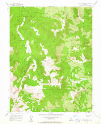
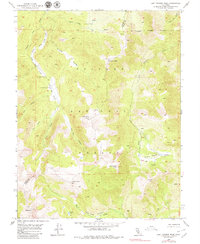
1954 Map of Lost Cannon Peak
USGS Topo · Published 1963About this map
High-altitude grazing land and alpine peaks define this 1954 survey of the California Sierra Nevada. The Toiyabe National Forest landscape is punctuated by remote landmarks like Connells Cow Camp and the dramatic drop of Llewellyn Falls along Silver Creek. This terrain, spanning the boundary between Alpine and Mono counties, reflects a mid-century period of wilderness management before the expansion of modern road networks.
Find a feature on this map
28 named features on this map. Tap any name to fly to it.
Don’t see what you’re looking for? This feature index may not catch every label — zoom into the map to look around manually.
Map Details
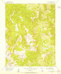
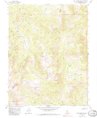
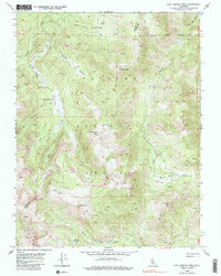
Editions of this 1954 Lost Cannon Peak Map
5 editions found
Other maps of this area

1889 · Markleeville
USGS Topo · 1:125,000

1891 · Markleeville
USGS Topo · 1:125,000

1891 · Wellington
USGS Topo · 1:125,000

1893 · Markleeville
USGS Topo · 1:125,000

1893 · Wellington
USGS Topo · 1:125,000

1896 · Dardanelles
USGS Topo · 1:125,000

1898 · Dardanelles
USGS Topo · 1:125,000

1909 · Bridgeport
USGS Topo · 1:125,000

1911 · Bridgeport
USGS Topo · 1:125,000

1920 · Bridgeport
USGS Topo · 1:125,000