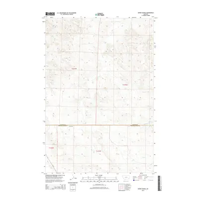
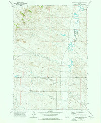
2014 Map of Divide School
USGS Topo · Published 2014About this map
Divide School stands as a focal point in this remote corner of southeastern Montana, situated precisely along the border of Custer and Powder River counties. The landscape is defined by an intricate network of seasonal drainage patterns, where Sand Cr and Beer Cr carve through the terrain. This topographic study reveals the sparse infrastructure of the region during the early 21st century, dominated by ranching and local water management features like Witcher Reservoir. The winding path of MT-59 provides the primary transit corridor through this section of the state, connecting isolated landmarks such as Road Cr and Big Bobcat Cr to the larger regional network. The map captures the quiet, agrarian character of the High Plains, where human imprints are limited to vital schools and water sources.
Find a feature on this map
13 named features on this map. Tap any name to fly to it.
Don’t see what you’re looking for? This feature index may not catch every label — zoom into the map to look around manually.
Map Details
Editions of this 2014 Divide School Map
This is the sole edition of this map. No revisions or reprints were ever made.
Other maps of this area

1954 · Ekalaka
USGS Topo · 1:250,000

1956 · Ekalaka
USGS Topo · 1:250,000

1958 · Ekalaka
USGS Topo · 1:250,000

1965 · Ekalaka
USGS Topo · 1:250,000
1973 · Harris Buttes
USGS Topo · 1:24,000
1973 · Saddle Horse Butte
USGS Topo · 1:24,000
1973 · Kirkpatrick Hill
USGS Topo · 1:24,000
1973 · Witcher Reservoir
USGS Topo · 1:24,000

1973 · Box Elder Creek
USGS Topo · 1:24,000

1973 · Coalwood
USGS Topo · 1:24,000