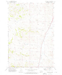
1973 Map of Kirkpatrick Hill
USGS Topo · Published 1976About this map
Kirkpatrick Hill rises as a prominent landmark in this section of Custer County, overlooking a network of seasonal drainages including Pumpkin Creek and Ash Creek. The landscape reflects a ranching-focused economy in the early 1970s, where movement is dictated by the terrain of Criswell Coulee and Kirkpatrick Draw. Unlike more developed regions, the settlement pattern here is sparse and utilitarian, anchored by locations like the Allen Ranch and small rural education centers such as Ash Creek Sch and the SY School.
Find a feature on this map
15 named features on this map. Tap any name to fly to it.
Don’t see what you’re looking for? This feature index may not catch every label — zoom into the map to look around manually.
Map Details
Editions of this 1973 Kirkpatrick Hill Map
This is the sole edition of this map. No revisions or reprints were ever made.
Other maps of this area

1953 · Miles City
USGS Topo · 1:250,000

1954 · Ekalaka
USGS Topo · 1:250,000

1956 · Ekalaka
USGS Topo · 1:250,000

1957 · Miles City
USGS Topo · 1:250,000

1958 · Miles City
USGS Topo · 1:250,000

1958 · Ekalaka
USGS Topo · 1:250,000

1965 · Ekalaka
USGS Topo · 1:250,000

1969 · Beebe SW
USGS Topo · 1:24,000
1969 · Beebe
USGS Topo · 1:24,000
1969 · Jack Creek
USGS Topo · 1:24,000