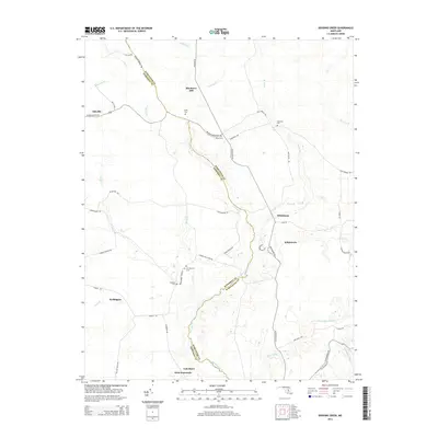
2014 Map of Dividing Creek
USGS Topo · Published 2014About this map
Dividing Cr serves as a natural and administrative boundary, threading through the landscape to separate Somerset and Worcester counties. This coastal plain region is marked by small settlements and a network of named branches and creeks, such as Politts Br and Kings Cr. The area around Oakville and Whiteburg shows a persistent rural character, where local history is anchored by numerous family and community burial grounds, including Pusey Cem, Nazareth Cem, and Olivet Cem. To the south, the terrain leads toward West Pocomoke and Cokesbury, with drainage features like Burk Mill Br and Cottingham Mill Run defining the low-lying geography. The map reveals a tapestry of long-established country roads, such as Sea Tick Rd and Old Furnace Rd, that connect these isolated hamlets and farmsteads.
Find a feature on this map
54 named features on this map. Tap any name to fly to it.
Don’t see what you’re looking for? This feature index may not catch every label — zoom into the map to look around manually.
Map Details
Editions of this 2014 Dividing Creek Map
This is the sole edition of this map. No revisions or reprints were ever made.
Other maps of this area

1901 · Snow Hill
USGS Topo · 1:62,500

1901 · Salisbury
USGS Topo · 1:62,500

1902 · Pittsville
USGS Topo · 1:62,500

1942 · Kingston
USGS Topo · 1:24,000

1942 · Princess Anne
USGS Topo · 1:24,000

1942 · Snow Hill
USGS Topo · 1:24,000

1942 · Eden
USGS Topo · 1:24,000

1942 · Wango
USGS Topo · 1:24,000

1942 · Dividing Creek
USGS Topo · 1:24,000

1942 · Salisbury
USGS Topo · 1:24,000