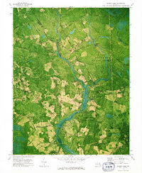
1973 Map of Dividing Creek
USGS Topo · Published 1975About this map
Dividing Creek carves a winding path through the heavy timber and wetlands along the Worcester Co Somerset Co line. In the early 1970s, this landscape was dominated by the expansive Pocomoke State Forest, where managed woodlands met small, isolated agricultural clearings. The map reveals a cluster of rural spiritual centers, including Friendship Ch, St Marys Ch, and Nazareth Ch, each serving the scattered communities of Oakville, West, and Whiteburg.
Find a feature on this map
61 named features on this map. Tap any name to fly to it.
Don’t see what you’re looking for? This feature index may not catch every label — zoom into the map to look around manually.
Map Details
Editions of this 1973 Dividing Creek Map
This is the sole edition of this map. No revisions or reprints were ever made.
Other maps of this area

1901 · Snow Hill
USGS Topo · 1:62,500

1901 · Salisbury
USGS Topo · 1:62,500

1902 · Pittsville
USGS Topo · 1:62,500

1942 · Kingston
USGS Topo · 1:24,000

1942 · Princess Anne
USGS Topo · 1:24,000

1942 · Snow Hill
USGS Topo · 1:24,000

1942 · Eden
USGS Topo · 1:24,000

1942 · Wango
USGS Topo · 1:24,000

1942 · Dividing Creek
USGS Topo · 1:24,000

1942 · Salisbury
USGS Topo · 1:24,000