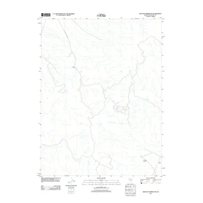
2011 Map of Dixie Hot Springs NE
USGS Topo · Published 2011About this map
Anderson Ranch sits at the heart of this high-desert landscape in Churchill County, representing the persistent ranching operations that define this part of the Nevada interior. The terrain is marked by a complex network of ephemeral drainages that converge from the surrounding highlands, notably through Iron Hat Canyon in the southeast. Transportation through this arid basin relies on the Coal Canyon-Stillwater Rd, which skirts the western edge of the mountains to connect disparate ranching outposts like the Bar A-3 Ranch. This 2011 survey illustrates the modern configuration of these historic grazing lands, where water access and primitive road networks dictate the placement of human activity amidst the vast alluvial fans and rugged desert topography.
Find a feature on this map
4 named features on this map. Tap any name to fly to it.
Don’t see what you’re looking for? This feature index may not catch every label — zoom into the map to look around manually.
Map Details
Editions of this 2011 Dixie Hot Springs NE Map
This is the sole edition of this map. No revisions or reprints were ever made.
Other maps of this area

1908 · Carson Sink
USGS Topo · 1:250,000

1910 · Carson Sink
USGS Topo · 1:250,000

1931 · Lovelock
USGS Topo · 1:250,000

1932 · Sonoma Range
USGS Topo · 1:250,000

1935 · Lovelock
USGS Topo · 1:250,000

1939 · Sonoma Range
USGS Topo · 1:250,000

1954 · Buffalo Mtn
USGS Topo · 1:62,500

1955 · Millett
USGS Topo · 1:250,000

1955 · Lovelock
USGS Topo · 1:250,000

1955 · Winnemucca
USGS Topo · 1:250,000