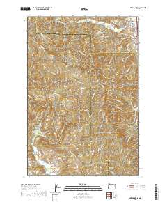
2020 Map of Dixie Mountain
USGS Topo · Published 2020About this map
Scappoose and its southern outskirts serve as the gateway to the rising elevations of the Tualatin Mountains in this modern survey. The map details the complex geography where the Columbia River floodplains meet the uplands of Strawberry Ridge and Dixie Mtn. This area is marked by a legacy of family and community heritage, evidenced by numerous small burial grounds such as Saint Wenceslaus Cem and Fairview Cem. A network of winding roads like NW Dixie Mountain Rd and NW Skyline Blvd navigates the drainages of S Scappoose Cr and McKay Cr. While South Scappoose and Johnson Crossing show more concentrated development, the western portions transition into more remote pockets like Brunswick Canyon and Pumpkin Ridge, interspersed with several small water management features including Howard Schmidt Reservoir and Nitchman Reservoir.
Find a feature on this map
88 named features on this map. Tap any name to fly to it.
Don’t see what you’re looking for? This feature index may not catch every label — zoom into the map to look around manually.
Map Details
Editions of this 2020 Dixie Mountain Map
This is the sole edition of this map. No revisions or reprints were ever made.
Other maps of this area

1915 · Hillsboro
USGS Topo · 1:62,500

1918 · Hillsboro
USGS Topo · 1:62,500

1922 · St. Helens
USGS Topo · 1:62,500

1940 · Hillsboro
USGS Topo · 1:62,500

1940 · Vernonia
USGS Topo · 1:62,500

1941 · St Helens
USGS Topo · 1:62,500

1941 · Gales Creek
USGS Topo · 1:62,500

1943 · Vernonia
USGS Topo · 1:62,500

1943 · St Helens
USGS Topo · 1:62,500

1948 · Vancouver
USGS Topo · 1:250,000