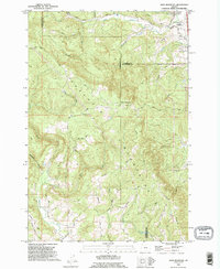
1990 Map of Dixie Mountain
USGS Topo · Published 1995About this map
Dixie Mountain stands as a prominent high point in the northern Tualatin Mountains, where the boundaries of Washington, Columbia, and Multnomah counties converge. In the early 1990s, this area reflects a rural landscape defined by deep canyons and timbered ridges, with the settlement of South Scappoose situated in the northeast. Transportation follows the complex topography, notably along Skyline Boulevard and family-named routes like Otto Miller Road and Stoltenberg Road. Genealogy and local history are anchored by long-established landmarks including Saint Wenceslaus Cemetery and Fairview Cem. Drainage systems such as South Scappoose Creek and East Fork McKay Creek carve through the terrain, illustrating the hydrologic network that supported early land claims and farming. The presence of Pumpkin Ridge and Mason Hill Park highlights the transition between agricultural use and protected spaces as the twentieth century neared its close.
Find a feature on this map
50 named features on this map. Tap any name to fly to it.
Don’t see what you’re looking for? This feature index may not catch every label — zoom into the map to look around manually.
Map Details
Editions of this 1990 Dixie Mountain Map
This is the sole edition of this map. No revisions or reprints were ever made.
Other maps of this area

1915 · Hillsboro
USGS Topo · 1:62,500

1918 · Hillsboro
USGS Topo · 1:62,500

1922 · St. Helens
USGS Topo · 1:62,500

1940 · Hillsboro
USGS Topo · 1:62,500

1940 · Vernonia
USGS Topo · 1:62,500

1941 · St Helens
USGS Topo · 1:62,500

1941 · Gales Creek
USGS Topo · 1:62,500

1943 · Vernonia
USGS Topo · 1:62,500

1943 · St Helens
USGS Topo · 1:62,500

1948 · Vancouver
USGS Topo · 1:250,000