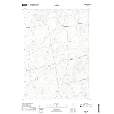
2018 Map of Dixmont
USGS Topo · Published 2018About this map
Mt Harris stands as a prominent topographical anchor overlooking the rural landscape of Penobscot and Waldo Counties. This 2018 survey documents the enduring settlement patterns of Dixmont, Troy, and the small community of North Dixmont. The area is defined by a series of small, family-named burial grounds and historical landmarks, including Mount Holly Cem, Webster Cem, and the community of Rollins Mills in the northeast. The drainage of Martin Stream and the wetlands of Cates Meadows suggest a landscape where agriculture and woodland have long coexisted. By tracing the paths of Bangor Rd and Western Ave, one can observe how these early thoroughfares connected the scattered hamlets and farmsteads. The map serves as a detailed guide to the region's genealogy, marking specific landmarks like Jewel Cem and Hathaway Cem that remain vital to local historical research.
Find a feature on this map
72 named features on this map. Tap any name to fly to it.
Don’t see what you’re looking for? This feature index may not catch every label — zoom into the map to look around manually.
Map Details
Editions of this 2018 Dixmont Map
This is the sole edition of this map. No revisions or reprints were ever made.
Other maps of this area

1926 · Burnham
USGS Topo · 1:62,500

1930 · Pittsfield
USGS Topo · 1:48,000

1931 · Stetson
USGS Topo · 1:48,000

1932 · Brooks
USGS Topo · 1:62,500

1932 · Pittsfield
USGS Topo · 1:62,500

1933 · Pittsfield
USGS Topo · 1:62,500

1935 · Stetson
USGS Topo · 1:62,500

1948 · Bangor
USGS Topo · 1:250,000

1955 · Pittsfield
USGS Topo · 1:62,500

1955 · Brooks
USGS Topo · 1:62,500