
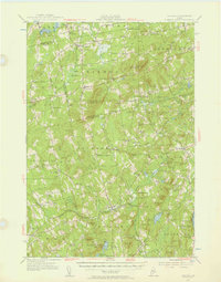
1955 Map of Brooks
USGS Topo · Published 1957About this map
Brooks and its surrounding Maine townships appear as a landscape of interconnected small settlements and agricultural highlands during the mid-1950s. The region is marked by numerous family-named corners and crossroads such as Hows Corners, Arnold Corner, and Jackson Corners, reflecting a deeply rooted rural genealogy. Topographical features like Mount Harris serve as anchors for regional navigation, hosting a Lookout Tower, while the nearby Airway Beacon on Peaked Mtn highlights the intersection of traditional terrain and modern aviation needs of the era.
Find a feature on this map
120 named features on this map. Tap any name to fly to it.
Don’t see what you’re looking for? This feature index may not catch every label — zoom into the map to look around manually.
Map Details
Editions of this 1955 Brooks Map
4 editions found
Other maps of this area

1900 · Bucksport
USGS Topo · 1:62,500

1902 · Bucksport
USGS Topo · 1:62,500

1902 · Bangor
USGS Topo · 1:62,500

1902 · Castine
USGS Topo · 1:62,500

1904 · Castine
USGS Topo · 1:62,500

1905 · Penobscot Bay
USGS Topo · 1:125,000

1915 · Belfast
USGS Topo · 1:62,500

1916 · Liberty
USGS Topo · 1:62,500

1917 · Belfast
USGS Topo · 1:62,500

1926 · Burnham
USGS Topo · 1:62,500