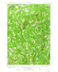
1955 Map of Brooks
USGS Topo · Published 1965About this map
The Belfast and Moosehead Lake Railroad cuts a diagonal path through this Waldo County landscape, connecting the rural communities of Knox Sta and Brooks. This mid-century survey reveals a patchwork of small agricultural settlements and wooded highlands, centered on the prominent Mount Harris Lookout Tower 1233. The map is particularly dense with family and community landmarks, including numerous small burial grounds like Hathaway Cem and Sawyer Cem, and local educational sites such as the Garfield Sch and Knowlton Sch.
Find a feature on this map
134 named features on this map. Tap any name to fly to it.
Don’t see what you’re looking for? This feature index may not catch every label — zoom into the map to look around manually.
Map Details
Editions of this 1955 Brooks Map
4 editions found

Other maps of this area

1900 · Bucksport
USGS Topo · 1:62,500

1902 · Bucksport
USGS Topo · 1:62,500

1902 · Bangor
USGS Topo · 1:62,500

1902 · Castine
USGS Topo · 1:62,500

1904 · Castine
USGS Topo · 1:62,500

1905 · Penobscot Bay
USGS Topo · 1:125,000

1915 · Belfast
USGS Topo · 1:62,500

1916 · Liberty
USGS Topo · 1:62,500

1917 · Belfast
USGS Topo · 1:62,500

1926 · Burnham
USGS Topo · 1:62,500