
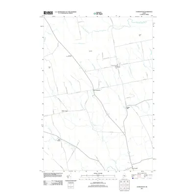
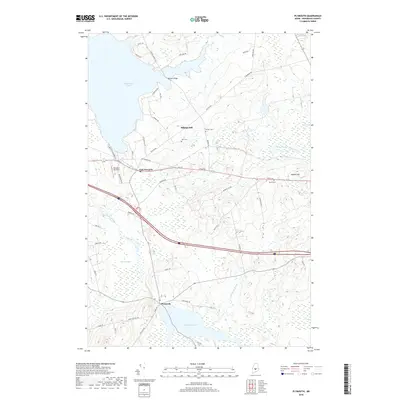
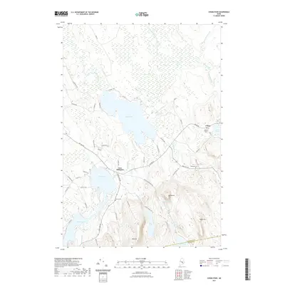
2024 Map of Dixmont
USGS Topo · Published 2024About this map
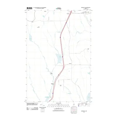
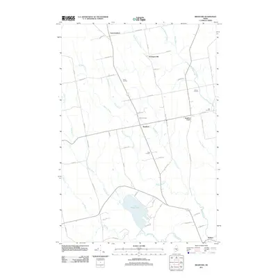
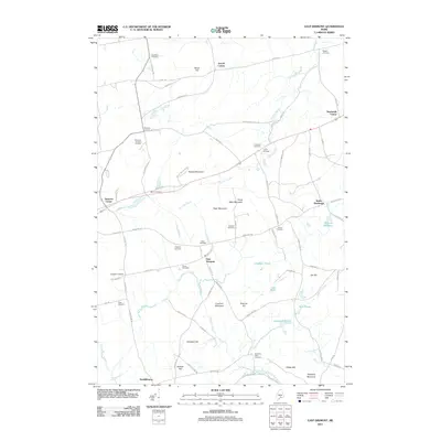
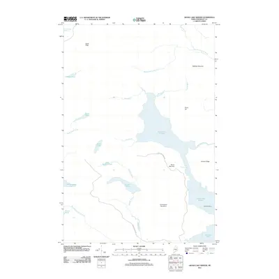
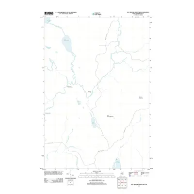
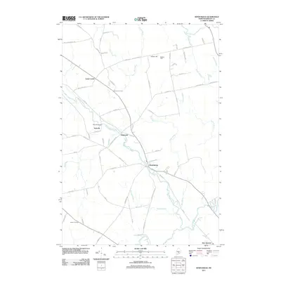
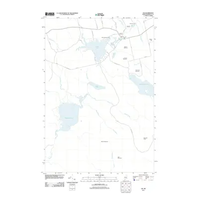
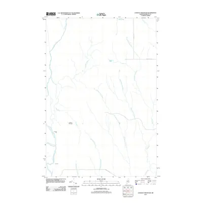
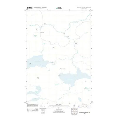
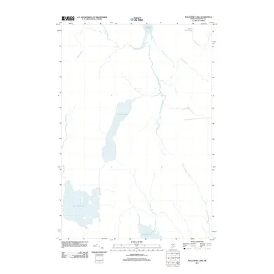
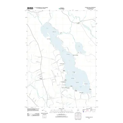
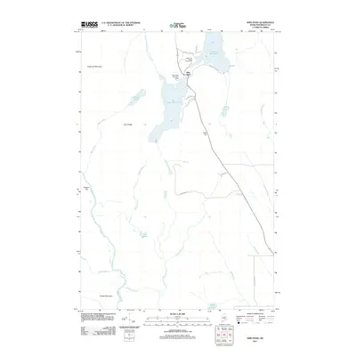
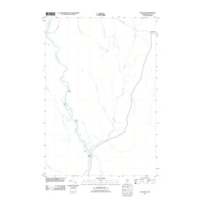
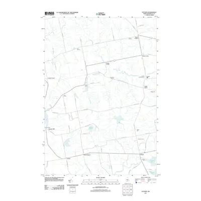
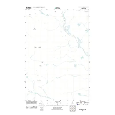
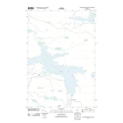
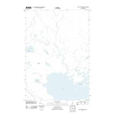
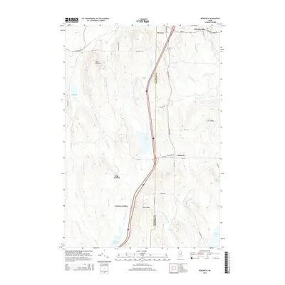
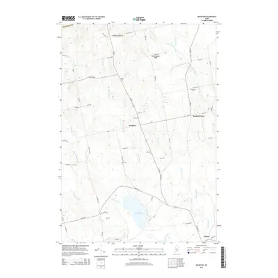
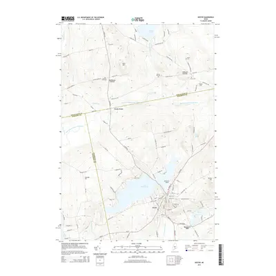
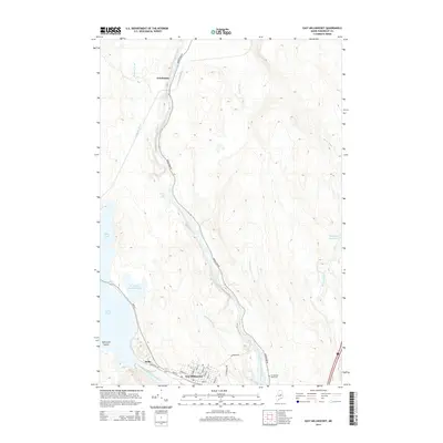
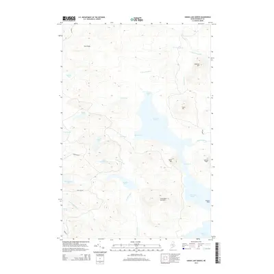
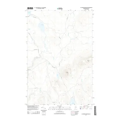
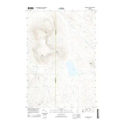
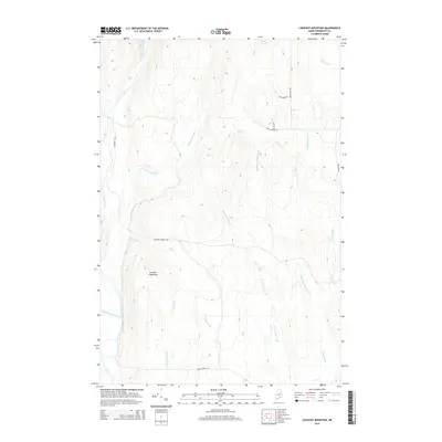
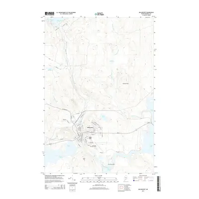
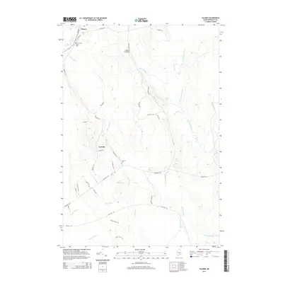
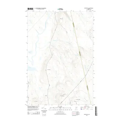
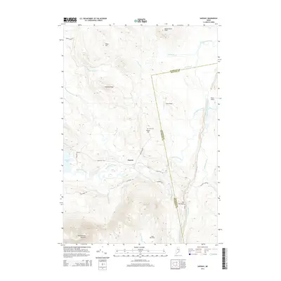
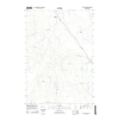
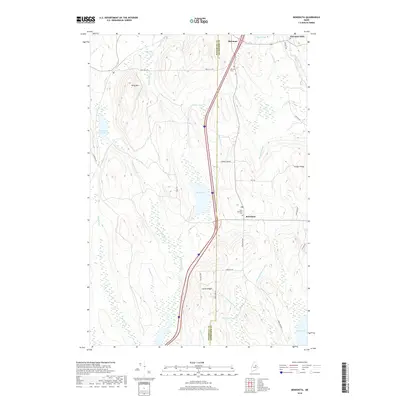
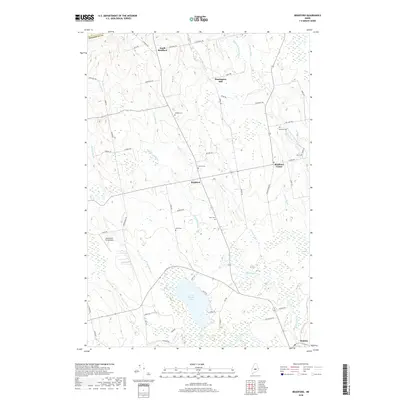
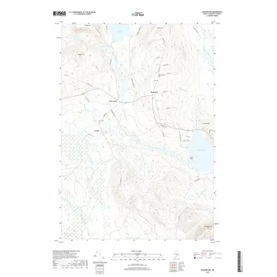
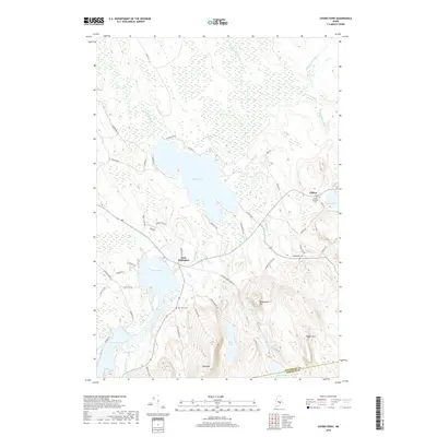
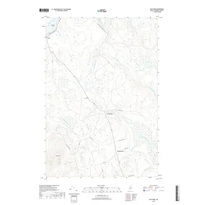
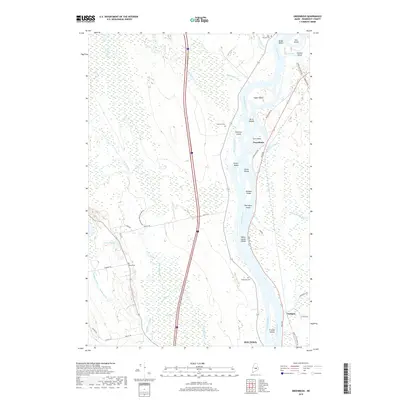
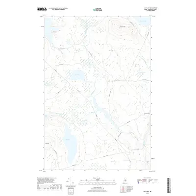
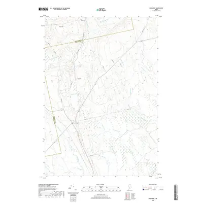
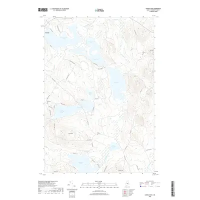
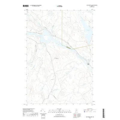
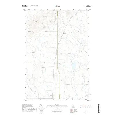
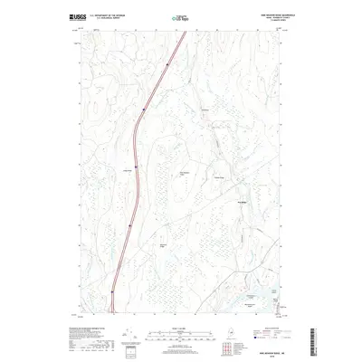
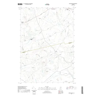
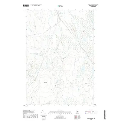
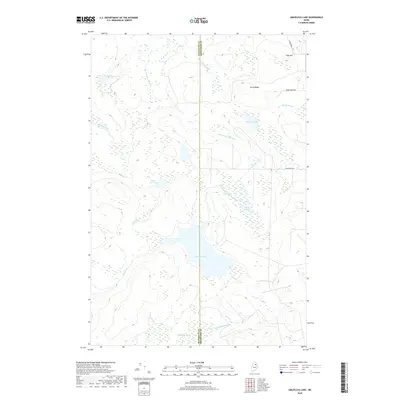
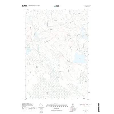
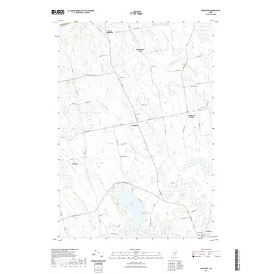
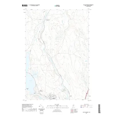
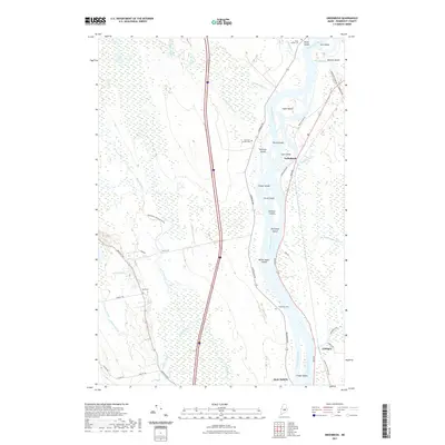
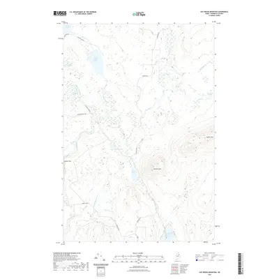
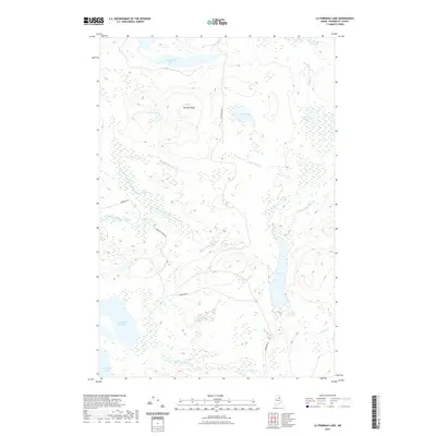
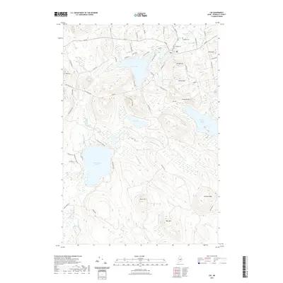
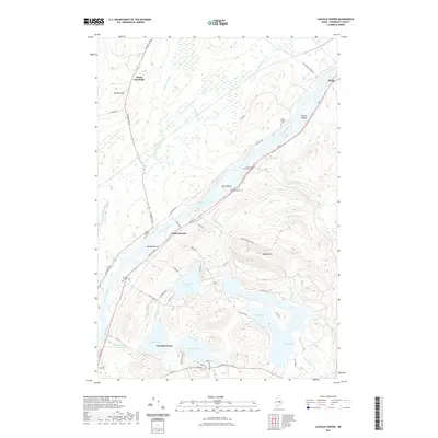
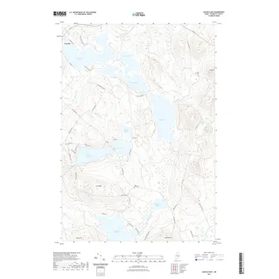
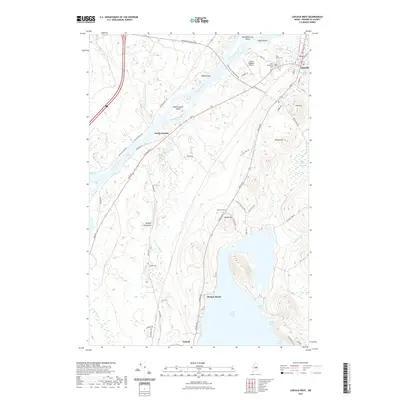
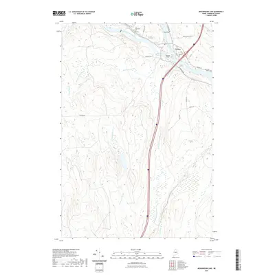
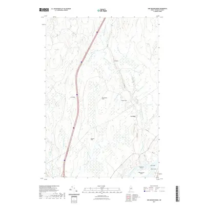
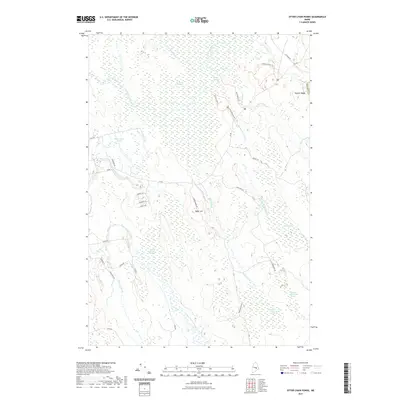
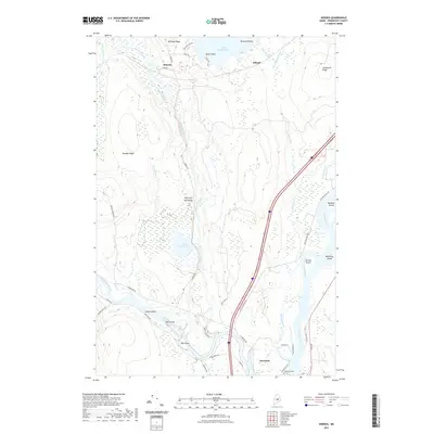
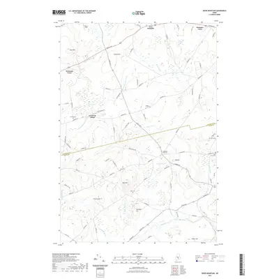
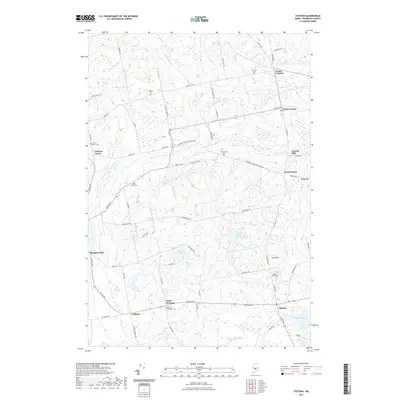
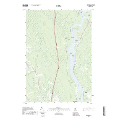
Mt Harris stands as a prominent landmark in this rural landscape where Penobscot and Waldo counties meet. The settlement patterns of Dixmont and North Dixmont are centered around historical road corridors like the Moosehead Trl, while the small cluster at Rollins Mills suggests earlier water-powered industry along Martin Stream. For genealogists, the map is remarkably dense with family-named burial sites, including the Sawyer Cem, Hathaway Cem, and Jewell Cem, many of which are tucked away from the main thoroughfares. The terrain is characterized by extensive wetlands such as Skinner Bog and Cates Meadows, which have historically dictated the placement of farms and connector roads like Troy Center Rd. The survey provides a clear view of the transition from the upland heights near Common Hill to the stream-fed basins of Bog Brook and Great Farm Brook.
Find a feature on this map
72 named features on this map. Tap any name to fly to it.
Don’t see what you’re looking for? This feature index may not catch every label — zoom into the map to look around manually.
Map Details
Editions of this 2024 Dixmont Map
This is the sole edition of this map. No revisions or reprints were ever made.
Historical Maps of Plymouth Through Time
511 maps found

1902 Orono
Penobscot County, ME

1917 Passadumkeag
Penobscot County, ME

1920 Winn
Penobscot County, ME

1931 Saponac
Penobscot County, ME

1931 Springfield
Penobscot County, ME

1931 Stetson
Penobscot County, ME

1933 Boyd Lake
Penobscot County, ME

1934 Saponac
Penobscot County, ME

1934 Springfield
Penobscot County, ME

1935 Stetson
Penobscot County, ME

1942 Lincoln
Penobscot County, ME

1944 Orono
Penobscot County, ME

1946 Orono
Penobscot County, ME

1951 Boyd Lake
Penobscot County, ME

1951 Millinocket
Penobscot County, ME

1951 Norcross
Penobscot County, ME

1953 Stacyville
Penobscot County, ME

1954 Grand Lake Seboeis
Penobscot County, ME

1954 Millinocket
Penobscot County, ME

1954 Shin Pond
Penobscot County, ME

1955 Boyd Lake
Penobscot County, ME

1955 Orono
Penobscot County, ME

1955 Stetson
Penobscot County, ME

1957 Lincoln
Penobscot County, ME

1957 Saponac
Penobscot County, ME

1958 Millinocket
Penobscot County, ME

1960 Millinocket
Penobscot County, ME

1960 Passadumkeag
Penobscot County, ME

1960 Winn
Penobscot County, ME

1975 Bradford
Penobscot County, ME

1975 Brooks NE
Penobscot County, ME

1975 Brooks NW
Penobscot County, ME

1975 Dover-Foxcroft SE
Penobscot County, ME

1975 Dover-Foxcroft SW
Penobscot County, ME

1975 Grand Lake Seboeis SE
Penobscot County, ME

1975 Grand Lake Seboeis SW
Penobscot County, ME

1975 Greenbush
Penobscot County, ME

1975 Guilford SE
Penobscot County, ME

1975 Howland
Penobscot County, ME

1975 Island Falls NW
Penobscot County, ME

1975 Island Falls SW
Penobscot County, ME

1975 Lincoln NE
Penobscot County, ME

1975 Lincoln NW
Penobscot County, ME

1975 Lincoln SE
Penobscot County, ME

1975 Lincoln SW
Penobscot County, ME

1975 Mattawamkeag NW
Penobscot County, ME

1975 Mattawamkeag SW
Penobscot County, ME

1975 Millinocket Lake SE
Penobscot County, ME

1975 Millinocket NE
Penobscot County, ME

1975 Millinocket SE
Penobscot County, ME

1975 Millinocket SW
Penobscot County, ME

1975 Olamon
Penobscot County, ME

1975 Oxbow SW
Penobscot County, ME

1975 Passadumkeag
Penobscot County, ME

1975 Saponac NE
Penobscot County, ME

1975 Saponac NW
Penobscot County, ME

1975 Saponac SW
Penobscot County, ME

1975 Sherman NW
Penobscot County, ME

1975 Sherman SW
Penobscot County, ME

1975 Shin Pond NE
Penobscot County, ME

1975 Shin Pond NW
Penobscot County, ME

1975 Shin Pond SE
Penobscot County, ME

1975 Shin Pond SW
Penobscot County, ME

1975 South Lagrange
Penobscot County, ME

1975 Springfield NE
Penobscot County, ME

1975 Springfield NW
Penobscot County, ME

1975 Springfield SE
Penobscot County, ME

1975 Springfield SW
Penobscot County, ME

1975 Stacyville NE
Penobscot County, ME

1975 Stacyville NW
Penobscot County, ME

1975 Stacyville SE
Penobscot County, ME

1975 Stacyville SW
Penobscot County, ME

1975 Stetson NE
Penobscot County, ME

1975 Stetson NW
Penobscot County, ME

1975 Stetson SW
Penobscot County, ME

1975 Traveler Mountain NE
Penobscot County, ME

1975 Traveler Mountain SE
Penobscot County, ME

1975 Winn NE
Penobscot County, ME

1975 Winn NW
Penobscot County, ME

1975 Winn SE
Penobscot County, ME

1975 Winn SW
Penobscot County, ME

1975 Wytopitlock SE
Penobscot County, ME

1975 Wytopitlock SW
Penobscot County, ME

1976 Stetson SE
Penobscot County, ME

1977 Kenduskeag
Penobscot County, ME

1977 Pushaw Lake
Penobscot County, ME

1978 Cedar Lake
Penobscot County, ME

1978 Endless Lake
Penobscot County, ME

1978 Hermon
Penobscot County, ME

1978 Katahdin Lake
Penobscot County, ME

1978 Lagrange
Penobscot County, ME

1978 Norcross
Penobscot County, ME

1978 Ragged Mountain
Penobscot County, ME

1978 Trout Mountain
Penobscot County, ME

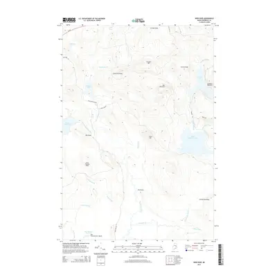
1981 Snow Mountain
Penobscot County, ME

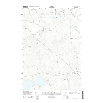
1981 West Corinth
Penobscot County, ME

1982 Carmel
Penobscot County, ME

1982 Dixmont
Penobscot County, ME

1982 East Dixmont
Penobscot County, ME

1982 Hampden
Penobscot County, ME

1982 Plymouth
Penobscot County, ME

1982 Snow Mountain
Penobscot County, ME

1982 Stetson
Penobscot County, ME

1982 West Corinth
Penobscot County, ME

1983 Bradford
Penobscot County, ME

1983 Charleston
Penobscot County, ME

1983 Garland
Penobscot County, ME

1983 Lagrange
Penobscot County, ME

1983 South Lagrange
Penobscot County, ME

1984 Dexter
Penobscot County, ME

1985 Grand Lake Seboeis
Penobscot County, ME

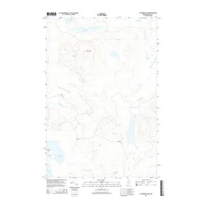
1985 La Pomkeag
Penobscot County, ME

1985 Lincoln
Penobscot County, ME

1985 Millinocket Lake East
Penobscot County, ME

1985 Millinocket
Penobscot County, ME

1986 Bowlin Brook
Penobscot County, ME

1986 Green Mountain
Penobscot County, ME

1986 Hay Brook Mtn
Penobscot County, ME

1986 Hay Lake
Penobscot County, ME

1986 La Pomkeag Lake
Penobscot County, ME

1986 Lincoln
Penobscot County, ME

1986 Mount Chase
Penobscot County, ME

1986 Shin Pond
Penobscot County, ME

1986 Umcolcus Lake
Penobscot County, ME

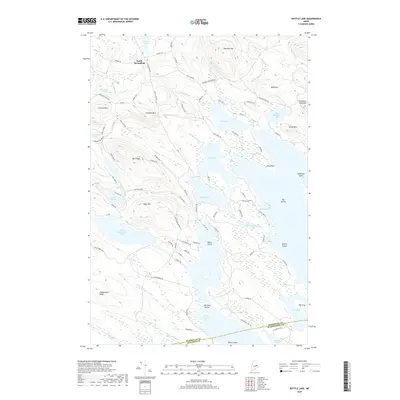
1988 Bottle Lake
Penobscot County, ME

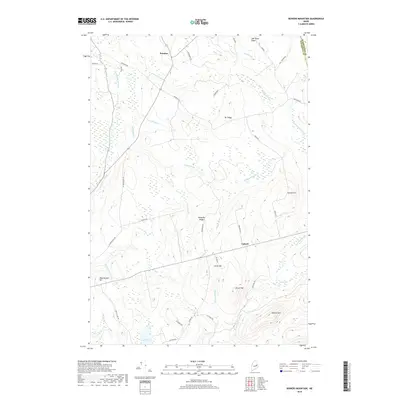
1988 Bowers Mountain
Penobscot County, ME

1988 Burlington
Penobscot County, ME

1988 Cedar Lake
Penobscot County, ME

1988 Chemo Pond
Penobscot County, ME

1988 East Millinocket
Penobscot County, ME

1988 East Winn
Penobscot County, ME

1988 Endless Lake
Penobscot County, ME

1988 Greenbush
Penobscot County, ME

1988 Greenfield
Penobscot County, ME

1988 Howland
Penobscot County, ME

1988 Katahdin Lake
Penobscot County, ME

1988 Kingman
Penobscot County, ME

1988 Lee
Penobscot County, ME

1988 Lincoln Center
Penobscot County, ME

1988 Lincoln East
Penobscot County, ME

1988 Lincoln West
Penobscot County, ME

1988 Mattamiscontis Mtn
Penobscot County, ME

1988 Mattaseunk Lake
Penobscot County, ME

1988 Medunkeunk Lake
Penobscot County, ME

1988 Millinocket
Penobscot County, ME

1988 Nine Meadow Ridge
Penobscot County, ME

1988 Nollesemic Lake
Penobscot County, ME

1988 Norcross
Penobscot County, ME

1988 Olamon
Penobscot County, ME

1988 Otter Chain Ponds
Penobscot County, ME

1988 Passadumkeag
Penobscot County, ME

1988 Potter Hill
Penobscot County, ME

1988 Ragged Mountain
Penobscot County, ME

1988 Salmon Stream Lake
Penobscot County, ME

1988 Saponac
Penobscot County, ME

1988 Seboeis
Penobscot County, ME

1988 Springfield
Penobscot County, ME

1988 Trout Brook Mtn
Penobscot County, ME

1988 Trout Mtn
Penobscot County, ME

1988 Weir Pond
Penobscot County, ME

1989 Benedicta
Penobscot County, ME

1989 Deasey Mountain
Penobscot County, ME

1989 Lookout Mountain
Penobscot County, ME

1989 Stacyville
Penobscot County, ME

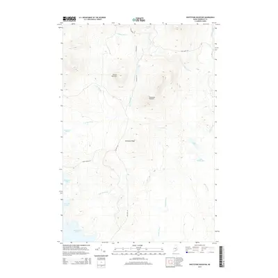
1989 Whetstone Mountain
Penobscot County, ME
2011 Benedicta
Penobscot County, ME
2011 Bottle Lake
Penobscot County, ME
2011 Bowers Mountain
Penobscot County, ME
2011 Bowlin Brook
Penobscot County, ME
2011 Bradford
Penobscot County, ME
2011 Burlington
Penobscot County, ME
2011 Carmel
Penobscot County, ME
2011 Cedar Lake
Penobscot County, ME
2011 Charleston
Penobscot County, ME
2011 Chemo Pond
Penobscot County, ME
2011 Deasey Mountain
Penobscot County, ME
2011 Dexter
Penobscot County, ME

2011 Dixmont
Penobscot County, ME
2011 East Dixmont
Penobscot County, ME

2011 East Millinocket
Penobscot County, ME
2011 East Winn
Penobscot County, ME
2011 Endless Lake
Penobscot County, ME
2011 Garland
Penobscot County, ME
2011 Grand Lake Seboeis
Penobscot County, ME
2011 Greenbush
Penobscot County, ME

2011 Greenfield
Penobscot County, ME
2011 Green Mountain
Penobscot County, ME
2011 Hampden
Penobscot County, ME
2011 Hay Brook Mountain
Penobscot County, ME
2011 Hay Lake
Penobscot County, ME
2011 Hermon
Penobscot County, ME
2011 Howland
Penobscot County, ME

2011 Katahdin Lake
Penobscot County, ME
2011 Kenduskeag
Penobscot County, ME
2011 Kingman
Penobscot County, ME
2011 Lagrange
Penobscot County, ME
2011 La Pomkeag Lake
Penobscot County, ME
2011 Lee
Penobscot County, ME
2011 Lincoln Center
Penobscot County, ME
2011 Lincoln East
Penobscot County, ME
2011 Lincoln West
Penobscot County, ME
2011 Lookout Mountain
Penobscot County, ME
2011 Mattamiscontis Mountain
Penobscot County, ME
2011 Mattaseunk Lake
Penobscot County, ME
2011 Medunkeunk Lake
Penobscot County, ME
2011 Millinocket Lake East
Penobscot County, ME
2011 Millinocket
Penobscot County, ME
2011 Mount Chase
Penobscot County, ME
2011 Nine Meadow Ridge
Penobscot County, ME
2011 Nollesemic Lake
Penobscot County, ME

2011 Norcross
Penobscot County, ME
2011 Olamon
Penobscot County, ME

2011 Otter Chain Ponds
Penobscot County, ME

2011 Passadumkeag
Penobscot County, ME
2011 Plymouth
Penobscot County, ME
2011 Potter Hill
Penobscot County, ME
2011 Pushaw Lake
Penobscot County, ME
2011 Ragged Mountain
Penobscot County, ME
2011 Salmon Stream Lake
Penobscot County, ME
2011 Saponac
Penobscot County, ME

2011 Seboeis
Penobscot County, ME
2011 Shin Pond
Penobscot County, ME
2011 Snow Mountain
Penobscot County, ME
2011 South Lagrange
Penobscot County, ME
2011 Springfield
Penobscot County, ME
2011 Stacyville
Penobscot County, ME
2011 Stetson
Penobscot County, ME
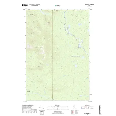
2011 The Traveler
Penobscot County, ME
2011 Trout Brook Mountain
Penobscot County, ME
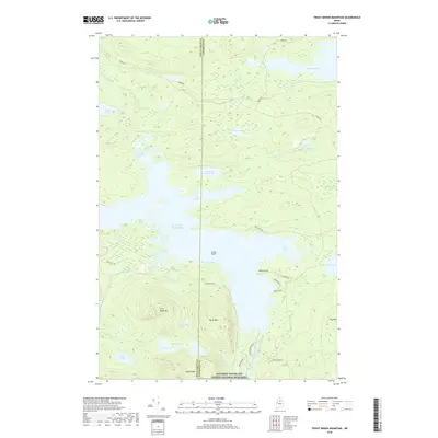
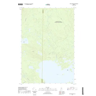
2011 Trout Mountain
Penobscot County, ME
2011 Umcolcus Lake
Penobscot County, ME
2011 Weir Pond
Penobscot County, ME
2011 West Corinth
Penobscot County, ME

2011 Whetstone Mountain
Penobscot County, ME
2014 Benedicta
Penobscot County, ME
2014 Bottle Lake
Penobscot County, ME
2014 Bowers Mountain
Penobscot County, ME
2014 Bowlin Brook
Penobscot County, ME
2014 Bradford
Penobscot County, ME
2014 Burlington
Penobscot County, ME

2014 Carmel
Penobscot County, ME
2014 Cedar Lake
Penobscot County, ME
2014 Charleston
Penobscot County, ME

2014 Chemo Pond
Penobscot County, ME
2014 Deasey Mountain
Penobscot County, ME
2014 Dexter
Penobscot County, ME
2014 Dixmont
Penobscot County, ME
2014 East Dixmont
Penobscot County, ME
2014 East Millinocket
Penobscot County, ME
2014 East Winn
Penobscot County, ME
2014 Endless Lake
Penobscot County, ME
2014 Garland
Penobscot County, ME
2014 Grand Lake Seboeis
Penobscot County, ME
2014 Greenbush
Penobscot County, ME
2014 Greenfield
Penobscot County, ME
2014 Green Mountain
Penobscot County, ME

2014 Hampden
Penobscot County, ME
2014 Hay Brook Mountain
Penobscot County, ME
2014 Hay Lake
Penobscot County, ME
2014 Hermon
Penobscot County, ME
2014 Howland
Penobscot County, ME
2014 Katahdin Lake
Penobscot County, ME
2014 Kenduskeag
Penobscot County, ME
2014 Kingman
Penobscot County, ME
2014 Lagrange
Penobscot County, ME
2014 La Pomkeag Lake
Penobscot County, ME
2014 Lee
Penobscot County, ME
2014 Lincoln Center
Penobscot County, ME
2014 Lincoln East
Penobscot County, ME

2014 Lincoln West
Penobscot County, ME
2014 Lookout Mountain
Penobscot County, ME
2014 Mattamiscontis Mountain
Penobscot County, ME
2014 Mattaseunk Lake
Penobscot County, ME
2014 Medunkeunk Lake
Penobscot County, ME

2014 Millinocket Lake East
Penobscot County, ME
2014 Millinocket
Penobscot County, ME
2014 Mount Chase
Penobscot County, ME

2014 Nine Meadow Ridge
Penobscot County, ME
2014 Nollesemic Lake
Penobscot County, ME
2014 Norcross
Penobscot County, ME
2014 Olamon
Penobscot County, ME
2014 Otter Chain Ponds
Penobscot County, ME
2014 Passadumkeag
Penobscot County, ME
2014 Plymouth
Penobscot County, ME
2014 Potter Hill
Penobscot County, ME
2014 Pushaw Lake
Penobscot County, ME
2014 Ragged Mountain
Penobscot County, ME
2014 Salmon Stream Lake
Penobscot County, ME
2014 Saponac
Penobscot County, ME
2014 Seboeis
Penobscot County, ME
2014 Shin Pond
Penobscot County, ME
2014 Snow Mountain
Penobscot County, ME
2014 South Lagrange
Penobscot County, ME
2014 Springfield
Penobscot County, ME
2014 Stacyville
Penobscot County, ME
2014 Stetson
Penobscot County, ME
2014 The Traveler
Penobscot County, ME
2014 Trout Brook Mountain
Penobscot County, ME
2014 Trout Mountain
Penobscot County, ME
2014 Umcolcus Lake
Penobscot County, ME
2014 Weir Pond
Penobscot County, ME
2014 West Corinth
Penobscot County, ME
2014 Whetstone Mountain
Penobscot County, ME
2018 Benedicta
Penobscot County, ME
2018 Bottle Lake
Penobscot County, ME
2018 Bowers Mountain
Penobscot County, ME
2018 Bowlin Brook
Penobscot County, ME
2018 Bradford
Penobscot County, ME
2018 Burlington
Penobscot County, ME
2018 Carmel
Penobscot County, ME
2018 Cedar Lake
Penobscot County, ME
2018 Charleston
Penobscot County, ME
2018 Chemo Pond
Penobscot County, ME
2018 Deasey Mountain
Penobscot County, ME
2018 Dexter
Penobscot County, ME

2018 Dixmont
Penobscot County, ME
2018 East Dixmont
Penobscot County, ME

2018 East Millinocket
Penobscot County, ME
2018 East Winn
Penobscot County, ME
2018 Endless Lake
Penobscot County, ME
2018 Garland
Penobscot County, ME
2018 Grand Lake Seboeis
Penobscot County, ME
2018 Greenbush
Penobscot County, ME

2018 Greenfield
Penobscot County, ME
2018 Green Mountain
Penobscot County, ME
2018 Hampden
Penobscot County, ME
2018 Hay Brook Mountain
Penobscot County, ME
2018 Hay Lake
Penobscot County, ME
2018 Hermon
Penobscot County, ME

2018 Howland
Penobscot County, ME

2018 Katahdin Lake
Penobscot County, ME
2018 Kenduskeag
Penobscot County, ME
2018 Kingman
Penobscot County, ME
2018 Lagrange
Penobscot County, ME
2018 La Pomkeag Lake
Penobscot County, ME
2018 Lee
Penobscot County, ME
2018 Lincoln Center
Penobscot County, ME
2018 Lincoln East
Penobscot County, ME
2018 Lincoln West
Penobscot County, ME
2018 Lookout Mountain
Penobscot County, ME
2018 Mattamiscontis Mountain
Penobscot County, ME
2018 Mattaseunk Lake
Penobscot County, ME
2018 Medunkeunk Lake
Penobscot County, ME
2018 Millinocket Lake East
Penobscot County, ME
2018 Millinocket
Penobscot County, ME
2018 Mount Chase
Penobscot County, ME
2018 Nine Meadow Ridge
Penobscot County, ME
2018 Nollesemic Lake
Penobscot County, ME

2018 Norcross
Penobscot County, ME
2018 Olamon
Penobscot County, ME

2018 Otter Chain Ponds
Penobscot County, ME

2018 Passadumkeag
Penobscot County, ME
2018 Plymouth
Penobscot County, ME
2018 Potter Hill
Penobscot County, ME
2018 Pushaw Lake
Penobscot County, ME
2018 Ragged Mountain
Penobscot County, ME
2018 Salmon Stream Lake
Penobscot County, ME
2018 Saponac
Penobscot County, ME

2018 Seboeis
Penobscot County, ME
2018 Shin Pond
Penobscot County, ME
2018 Snow Mountain
Penobscot County, ME
2018 South Lagrange
Penobscot County, ME
2018 Springfield
Penobscot County, ME
2018 Stacyville
Penobscot County, ME
2018 Stetson
Penobscot County, ME
2018 The Traveler
Penobscot County, ME
2018 Trout Brook Mountain
Penobscot County, ME
2018 Trout Mountain
Penobscot County, ME
2018 Umcolcus Lake
Penobscot County, ME
2018 Weir Pond
Penobscot County, ME
2018 West Corinth
Penobscot County, ME

2018 Whetstone Mountain
Penobscot County, ME
2021 Benedicta
Penobscot County, ME

2021 Bottle Lake
Penobscot County, ME

2021 Bowers Mountain
Penobscot County, ME
2021 Bowlin Brook
Penobscot County, ME
2021 Bradford
Penobscot County, ME
2021 Burlington
Penobscot County, ME
2021 Carmel
Penobscot County, ME
2021 Cedar Lake
Penobscot County, ME

2021 Charleston
Penobscot County, ME
2021 Chemo Pond
Penobscot County, ME

2021 Deasey Mountain
Penobscot County, ME
2021 Dexter
Penobscot County, ME
2021 Dixmont
Penobscot County, ME
2021 East Dixmont
Penobscot County, ME
2021 East Millinocket
Penobscot County, ME
2021 East Winn
Penobscot County, ME
2021 Endless Lake
Penobscot County, ME

2021 Garland
Penobscot County, ME
2021 Grand Lake Seboeis
Penobscot County, ME
2021 Greenbush
Penobscot County, ME
2021 Greenfield
Penobscot County, ME
2021 Green Mountain
Penobscot County, ME
2021 Hampden
Penobscot County, ME
2021 Hay Brook Mountain
Penobscot County, ME
2021 Hay Lake
Penobscot County, ME
2021 Hermon
Penobscot County, ME
2021 Howland
Penobscot County, ME
2021 Katahdin Lake
Penobscot County, ME
2021 Kenduskeag
Penobscot County, ME
2021 Kingman
Penobscot County, ME
2021 Lagrange
Penobscot County, ME
2021 La Pomkeag Lake
Penobscot County, ME
2021 Lee
Penobscot County, ME
2021 Lincoln Center
Penobscot County, ME
2021 Lincoln East
Penobscot County, ME
2021 Lincoln West
Penobscot County, ME
2021 Lookout Mountain
Penobscot County, ME
2021 Mattamiscontis Mountain
Penobscot County, ME
2021 Mattaseunk Lake
Penobscot County, ME
2021 Medunkeunk Lake
Penobscot County, ME
2021 Millinocket Lake East
Penobscot County, ME
2021 Millinocket
Penobscot County, ME
2021 Mount Chase
Penobscot County, ME
2021 Nine Meadow Ridge
Penobscot County, ME
2021 Nollesemic Lake
Penobscot County, ME
2021 Norcross
Penobscot County, ME
2021 Olamon
Penobscot County, ME
2021 Otter Chain Ponds
Penobscot County, ME
2021 Passadumkeag
Penobscot County, ME
2021 Plymouth
Penobscot County, ME

2021 Potter Hill
Penobscot County, ME

2021 Pushaw Lake
Penobscot County, ME
2021 Ragged Mountain
Penobscot County, ME
2021 Salmon Stream Lake
Penobscot County, ME
2021 Saponac
Penobscot County, ME
2021 Seboeis
Penobscot County, ME
2021 Shin Pond
Penobscot County, ME
2021 Snow Mountain
Penobscot County, ME
2021 South Lagrange
Penobscot County, ME
2021 Springfield
Penobscot County, ME
2021 Stacyville
Penobscot County, ME
2021 Stetson
Penobscot County, ME
2021 The Traveler
Penobscot County, ME
2021 Trout Brook Mountain
Penobscot County, ME
2021 Trout Mountain
Penobscot County, ME
2021 Umcolcus Lake
Penobscot County, ME
2021 Weir Pond
Penobscot County, ME
2021 West Corinth
Penobscot County, ME
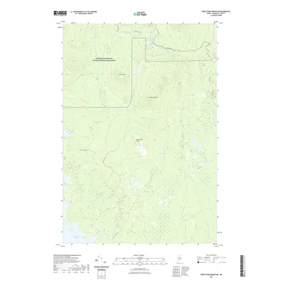
2021 Whetstone Mountain
Penobscot County, ME
2023 Greenbush
Penobscot County, ME

2024 Benedicta
Penobscot County, ME

2024 Bottle Lake
Penobscot County, ME

2024 Bowers Mountain
Penobscot County, ME

2024 Bowlin Brook
Penobscot County, ME

2024 Bradford
Penobscot County, ME

2024 Burlington
Penobscot County, ME

2024 Carmel
Penobscot County, ME

2024 Cedar Lake
Penobscot County, ME

2024 Charleston
Penobscot County, ME

2024 Chemo Pond
Penobscot County, ME

2024 Deasey Mountain
Penobscot County, ME

2024 Dexter
Penobscot County, ME
2024 Dixmont
Penobscot County, ME

2024 East Dixmont
Penobscot County, ME

2024 East Millinocket
Penobscot County, ME

2024 East Winn
Penobscot County, ME

2024 Endless Lake
Penobscot County, ME

2024 Garland
Penobscot County, ME

2024 Grand Lake Seboeis
Penobscot County, ME

2024 Greenbush
Penobscot County, ME

2024 Greenfield
Penobscot County, ME

2024 Green Mountain
Penobscot County, ME

2024 Hampden
Penobscot County, ME

2024 Hay Brook Mountain
Penobscot County, ME

2024 Hay Lake
Penobscot County, ME

2024 Hermon
Penobscot County, ME

2024 Howland
Penobscot County, ME

2024 Katahdin Lake
Penobscot County, ME

2024 Kenduskeag
Penobscot County, ME

2024 Kingman
Penobscot County, ME

2024 Lagrange
Penobscot County, ME

2024 La Pomkeag Lake
Penobscot County, ME

2024 Lee
Penobscot County, ME

2024 Lincoln Center
Penobscot County, ME

2024 Lincoln East
Penobscot County, ME

2024 Lincoln West
Penobscot County, ME

2024 Lookout Mountain
Penobscot County, ME

2024 Mattamiscontis Mountain
Penobscot County, ME

2024 Mattaseunk Lake
Penobscot County, ME

2024 Medunkeunk Lake
Penobscot County, ME

2024 Millinocket Lake East
Penobscot County, ME

2024 Millinocket
Penobscot County, ME

2024 Mount Chase
Penobscot County, ME

2024 Nine Meadow Ridge
Penobscot County, ME

2024 Nollesemic Lake
Penobscot County, ME

2024 Norcross
Penobscot County, ME

2024 Olamon
Penobscot County, ME

2024 Otter Chain Ponds
Penobscot County, ME

2024 Passadumkeag
Penobscot County, ME

2024 Plymouth
Penobscot County, ME

2024 Potter Hill
Penobscot County, ME

2024 Pushaw Lake
Penobscot County, ME

2024 Ragged Mountain
Penobscot County, ME

2024 Salmon Stream Lake
Penobscot County, ME

2024 Saponac
Penobscot County, ME

2024 Seboeis
Penobscot County, ME

2024 Shin Pond
Penobscot County, ME

2024 Snow Mountain
Penobscot County, ME

2024 South Lagrange
Penobscot County, ME

2024 Springfield
Penobscot County, ME

2024 Stacyville
Penobscot County, ME

2024 Stetson
Penobscot County, ME

2024 The Traveler
Penobscot County, ME

2024 Trout Brook Mountain
Penobscot County, ME

2024 Trout Mountain
Penobscot County, ME

2024 Umcolcus Lake
Penobscot County, ME

2024 Weir Pond
Penobscot County, ME

2024 West Corinth
Penobscot County, ME

2024 Whetstone Mountain
Penobscot County, ME