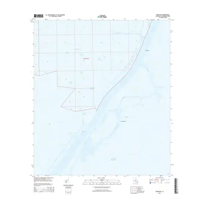
2015 Map of Dixon Bay
USGS Topo · Published 2015About this map
Southwest Pass dominates this coastal landscape at the edge of the Mississippi River Delta, serving as a critical navigable artery leading into the Gulf of Mexico. The area is characterized by a complex network of branching waterways and outlets, including Joseph Bayou and Double Bayou, which weave through the shifting wetlands of Plaquemines Parish. On the eastern edge of the pass, the southern tip of Grand Isle appears, marking a transition between the sheltered waters of Caminada Pass and the open gulf.
Find a feature on this map
25 named features on this map. Tap any name to fly to it.
Don’t see what you’re looking for? This feature index may not catch every label — zoom into the map to look around manually.
Map Details
Editions of this 2015 Dixon Bay Map
This is the sole edition of this map. No revisions or reprints were ever made.
Other maps of this area

1893 · East Delta
USGS Topo · 1:62,500

1893 · West Delta
USGS Topo · 1:62,500

1935 · South Pass
USGS Topo · 1:31,680

1946 · Pass Du Bois
USGS Topo · 1:31,680

1946 · Mudpan Bayou
USGS Topo · 1:31,680

1946 · Pass Tante Phine
USGS Topo · 1:31,680

1947 · Pass A Loutre West
USGS Topo · 1:31,680

1947 · Southwest Pass
USGS Topo · 1:31,680

1949 · Cubits Gap
USGS Topo · 1:31,680
1949 · Burrwood
USGS Topo · 1:31,680