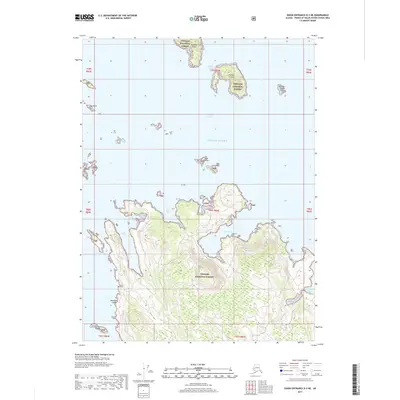
2017 Map of Dixon Entrance D-3 NE
USGS Topo · Published 2017About this map
Sukkwan Island and Jackson Island anchor the northern reaches of this archipelago, situated where the Tlevak Strait meets the open waters of the Gulf of Alaska. The landscape is dominated by the dense, protected wilderness of the Tongass National Forest, which covers the fragmented islands and the larger landmass to the south. A complex network of waterways defines the region, including the deep recess of Shoe Inlet and the sheltered Cleva Bay. This 2017 survey reveals a maritime environment largely untouched by development, focused instead on the natural indentation of the coastline at Touchit Cove, Dova Bay, and Ellen Bay. Isolated landmarks like Dead Pine Island and the Channel Islands serve as critical navigation points for those traversing these remote coastal waters, where the terrain is defined by its dramatic relationship with the sea.
Find a feature on this map
25 named features on this map. Tap any name to fly to it.
Don’t see what you’re looking for? This feature index may not catch every label — zoom into the map to look around manually.
Map Details
Editions of this 2017 Dixon Entrance D-3 NE Map
This is the sole edition of this map. No revisions or reprints were ever made.
Other maps of this area

1948 · Dixon Entrance D-2
USGS Topo · 1:63,360

1948 · Dixon Entrance D-3
USGS Topo · 1:63,360

1948 · Craig A-3
USGS Topo · 1:63,360

1948 · Craig A-2
USGS Topo · 1:63,360

1951 · Dixon Entrance
USGS Topo · 1:250,000

1951 · Dixon Entrance D-3
USGS Topo · 1:63,360

1951 · Dixon Entrance D-2
USGS Topo · 1:63,360

1951 · Craig A-2
USGS Topo · 1:63,360

1951 · Craig A-3
USGS Topo · 1:63,360

1957 · Craig
USGS Topo · 1:250,000