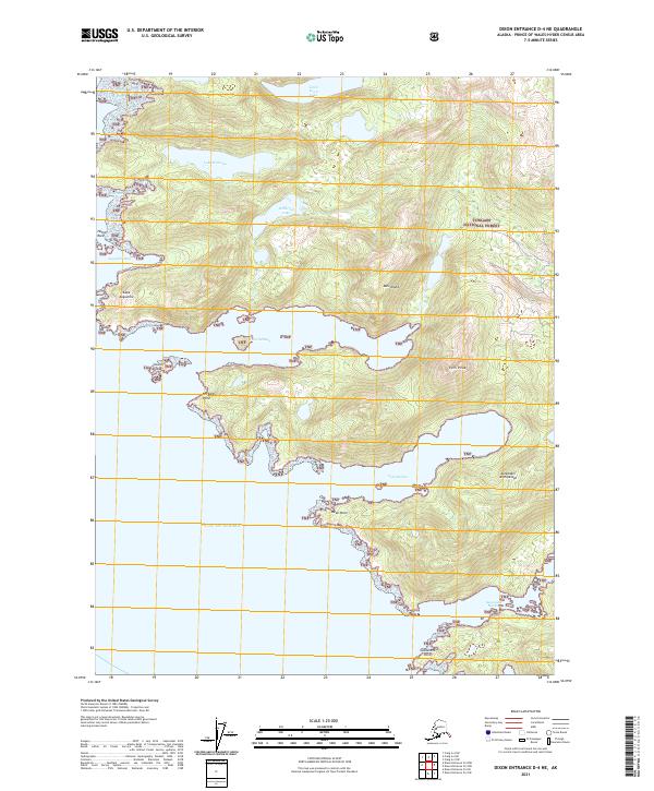
2021 Map of Dixon Entrance D-4 NE
USGS Topo · Published 2021About this map
Dall Island dominates this coastal survey, showcasing a landscape of significant elevation changes and intricate shorelines within the Alexander Archipelago. The terrain is defined by prominent heights like Twin Peaks and numerous freshwater bodies situated at varying elevations, including Little Devil Lake, Lake Welcome, and Waterfall Lake. These lakes are clustered in the northern portion of the island, suggesting a complex interior drainage system that feeds toward the coast.
Find a feature on this map
24 named features on this map. Tap any name to fly to it.
Don’t see what you’re looking for? This feature index may not catch every label — zoom into the map to look around manually.
Map Details
Editions of this 2021 Dixon Entrance D-4 NE Map
This is the sole edition of this map. No revisions or reprints were ever made.
Other maps of this area

1948 · Craig A-4
USGS Topo · 1:63,360

1948 · Dixon Entrance D-4
USGS Topo · 1:63,360

1948 · Dixon Entrance D-3
USGS Topo · 1:63,360

1948 · Craig A-3
USGS Topo · 1:63,360

1951 · Dixon Entrance
USGS Topo · 1:250,000

1951 · Dixon Entrance D-3
USGS Topo · 1:63,360

1951 · Craig A-4
USGS Topo · 1:63,360

1951 · Craig A-3
USGS Topo · 1:63,360
1951 · Dixon Entrance D-4
USGS Topo · 1:63,360

1957 · Craig
USGS Topo · 1:250,000