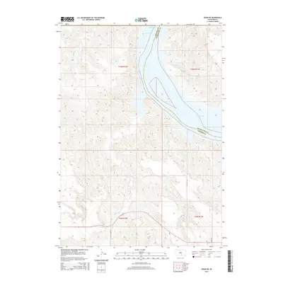
2015 Map of Dixon NE
USGS Topo · Published 2015About this map
The Missouri River forms the central corridor of this South Dakota landscape, defining the jagged border between Gregory and Charles Mix counties. This portion of the river is dominated by the expansive Lake Francis Case, a reservoir created by mid-century damming that significantly altered the valley's original topography and hydrology. Tributaries like Fivemile Cr, Dry Cr, and the winding Landing Cr cut through the high western plains, creating a network of deep drainages that flow toward the main river channel.
Find a feature on this map
17 named features on this map. Tap any name to fly to it.
Don’t see what you’re looking for? This feature index may not catch every label — zoom into the map to look around manually.
Map Details
Editions of this 2015 Dixon NE Map
This is the sole edition of this map. No revisions or reprints were ever made.
Other maps of this area

1940 · Iona
USGS Topo · 1:62,500

1944 · Iona
USGS Topo · 1:62,500

1955 · Mitchell
USGS Topo · 1:250,000

1959 · Mitchell
USGS Topo · 1:250,000

1971 · Lucas NW
USGS Topo · 1:24,000

1971 · Dixon SW
USGS Topo · 1:24,000

1971 · Lucas
USGS Topo · 1:24,000

1971 · Dixon
USGS Topo · 1:24,000

1971 · Dixon SE
USGS Topo · 1:24,000

1971 · Dixon NE
USGS Topo · 1:24,000
Featured Places
- America Township, SD
- La Roche Township, SD
- Bull Creek Segment, SD
- Milk's Camp Segment, SD
- Charles Mix County, SD