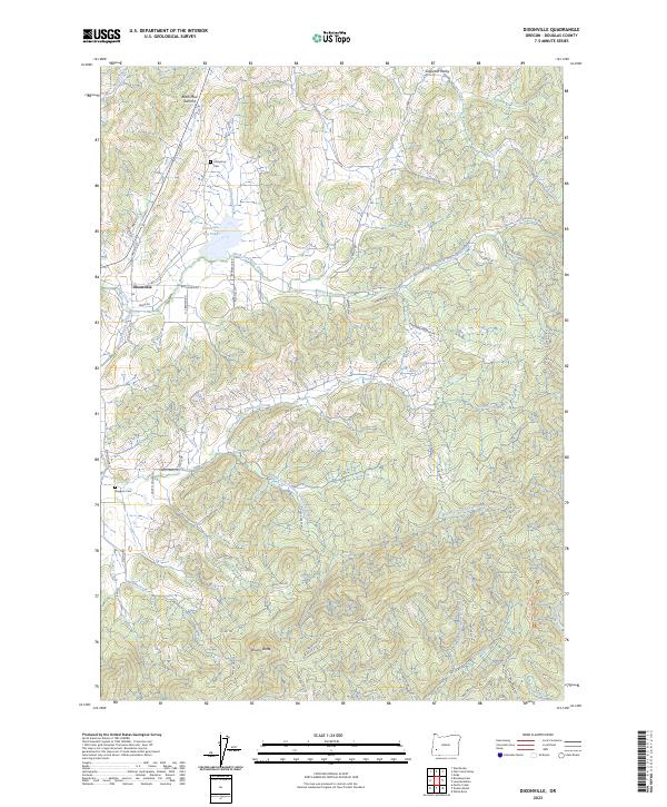
2023 Map of Dixonville
USGS Topo · Published 2023About this map
Dixonville lies at the convergence of valley terrain and the rising uplands of Douglas County, where the Dixonville Log Pond serves as a prominent landmark of the local timber landscape. The geography is defined by the intricate drainage systems of the Deer Creek forks, with the North Fork Deer Creek and South Fork Deer Creek carving through a complex of ridges and peaks like Black Mud Summit and Brushy Butte. This 2023 survey illustrates a rural environment where modern resource management roads, such as BLM RD 27-4-15.0 and BLM RD 28-4-28, interlace with older local identifiers.
Find a feature on this map
68 named features on this map. Tap any name to fly to it.
Don’t see what you’re looking for? This feature index may not catch every label — zoom into the map to look around manually.
Map Details
Editions of this 2023 Dixonville Map
This is the sole edition of this map. No revisions or reprints were ever made.
Other maps of this area

1897 · Roseburg
USGS Topo · 1:125,000

1900 · Roseburg
USGS Topo · 1:125,000

1954 · Dixonville
USGS Topo · 1:62,500

1954 · Sutherlin
USGS Topo · 1:62,500

1954 · Glide
USGS Topo · 1:62,500

1955 · Roseburg
USGS Topo · 1:62,500

1958 · Roseburg
USGS Topo · 1:250,000

1959 · Roseburg
USGS Topo · 1:250,000

1979 · Roseburg
USGS Topo · 1:100,000
1987 · Roseburg East
USGS Topo · 1:24,000