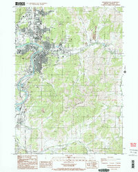
1987 Map of Roseburg East
USGS Topo · Published 1987About this map
The South Fork Umpqua River winds through this Douglas County landscape, serving as a primary corridor for both transportation and community development. By the late 1980s, Roseburg had expanded its municipal footprint with significant infrastructure, including the Municipal Airport and the VA Hospital. The presence of the Southern Pacific railroad and Interstate 5 underscores the area's role as a regional transit hub, while smaller outlying settlements like Green, Roberts, and Glengary retain their distinct identities. Cultural and recreational sites are well-represented, from the County Fairgrounds to the Drive in Theater south of town. The surrounding terrain is marked by numerous quarries and significant elevations like Burg Mountain and Mount Rose, highlighting the intersection of industrial resource extraction and the residential expansion of the Oregon interior.
Find a feature on this map
52 named features on this map. Tap any name to fly to it.
Don’t see what you’re looking for? This feature index may not catch every label — zoom into the map to look around manually.
Map Details
Editions of this 1987 Roseburg East Map
2 editions found
Other maps of this area

1897 · Roseburg
USGS Topo · 1:125,000

1900 · Roseburg
USGS Topo · 1:125,000

1954 · Dixonville
USGS Topo · 1:62,500

1954 · Sutherlin
USGS Topo · 1:62,500

1954 · Glide
USGS Topo · 1:62,500

1955 · Roseburg
USGS Topo · 1:62,500

1958 · Roseburg
USGS Topo · 1:250,000

1959 · Roseburg
USGS Topo · 1:250,000

1979 · Roseburg
USGS Topo · 1:100,000
1987 · Myrtle Creek
USGS Topo · 1:24,000