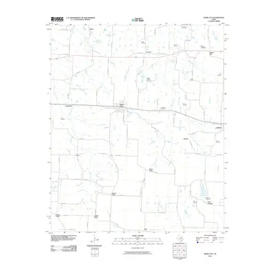
2010 Map of Dodd City
USGS Topo · Published 2010About this map
Dodd City and the neighboring community of Windom anchor this landscape in Fannin County, characterized by a dense network of county roads and numerous rural cemeteries. The area is defined by its small, scattered settlements such as Lannius, Spring Hill, and Prairie Point, which serve as reminders of the region's agricultural roots. A series of small waterways, including Bullard Creek, Sloans Creek, and Onstott Branch, drain the terrain, which is also dotted with private ranch impoundments like the Happy J Ranch Lake Dam. Genealogists will find significant value in the distribution of family and community burial grounds, including Shilo Cemetery, Boze Cemetery, and Wall Cemetery. The map reflects a modern rural Texas environment where historical hamlets like Hilger and Flag Springs persist alongside established county thoroughfares like FM 897 and FM 1743.
Find a feature on this map
89 named features on this map. Tap any name to fly to it.
Don’t see what you’re looking for? This feature index may not catch every label — zoom into the map to look around manually.
Map Details
Editions of this 2010 Dodd City Map
This is the sole edition of this map. No revisions or reprints were ever made.
Other maps of this area

1903 · Paris
USGS Topo · 1:125,000

1947 · Honey Grove
USGS Topo · 1:62,500

1949 · Honey Grove
USGS Topo · 1:62,500

1953 · Texarkana
USGS Topo · 1:250,000

1954 · Sherman
USGS Topo · 1:250,000

1956 · Texarkana
USGS Topo · 1:250,000

1958 · Bonham
USGS Topo · 1:62,500

1958 · Sherman
USGS Topo · 1:250,000

1964 · Ladonia
USGS Topo · 1:24,000
1964 · Gober
USGS Topo · 1:24,000