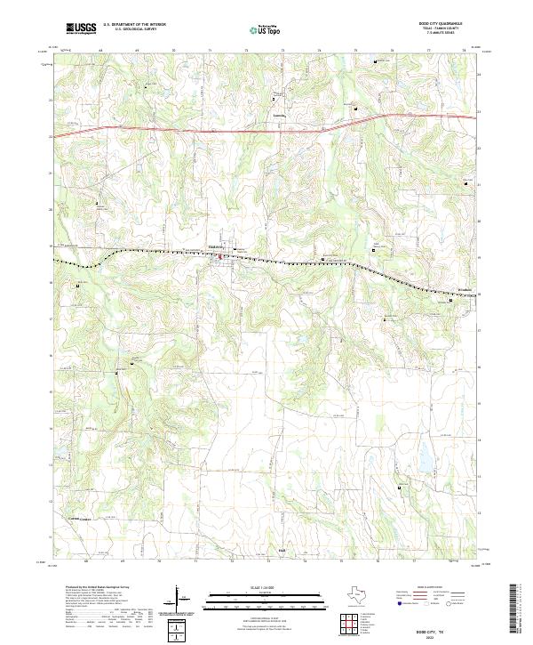
2022 Map of Dodd City
USGS Topo · Published 2022About this map
Dodd City and the surrounding Fannin County landscape are defined by a dense network of family-named burial grounds and seasonal drainage creeks. This rural corridor between Lannius and Windom reveals a settlement pattern tied to the fertile prairie, where small communities like Cotton Center and Hail grew up alongside tributaries such as Bullard Cr and Sloans Cr. The numerous small cemeteries, including Beasley Vault Cem and the Chesson Family Cem, suggest a history of private family landholdings and early homesteads that have persisted through generations. Major transport routes like E Sam Rayburn Dr and W Sam Rayburn Rd anchor the modern geography, following the traditional east-west paths through the county, while the winding course of Powder Cr and Long Br trace the natural contours of the northern Texas terrain.
Find a feature on this map
83 named features on this map. Tap any name to fly to it.
Don’t see what you’re looking for? This feature index may not catch every label — zoom into the map to look around manually.
Map Details
Editions of this 2022 Dodd City Map
This is the sole edition of this map. No revisions or reprints were ever made.
Other maps of this area

1903 · Paris
USGS Topo · 1:125,000

1947 · Honey Grove
USGS Topo · 1:62,500

1949 · Honey Grove
USGS Topo · 1:62,500

1953 · Texarkana
USGS Topo · 1:250,000

1954 · Sherman
USGS Topo · 1:250,000

1956 · Texarkana
USGS Topo · 1:250,000

1958 · Bonham
USGS Topo · 1:62,500

1958 · Sherman
USGS Topo · 1:250,000

1964 · Ladonia
USGS Topo · 1:24,000
1964 · Gober
USGS Topo · 1:24,000