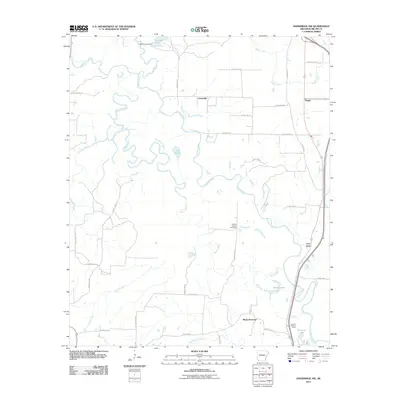
2011 Map of Doddridge NW
USGS Topo · Published 2011About this map
The Sulphur River and its intricate network of tributaries define the landscape of Miller County as it appeared in the early 21st century. This map reveals a complex wetland environment where the river meanders through oxbows and backwaters like Mercer Bayou and Little Pond. Small rural communities and named clusters such as Jonesville, Boggy, and Fort Lynn are scattered across a grid of county roads, showing the persistent settlement patterns of southwest Arkansas. Industry is represented by the Millett Oil and Gas Field, while forestry and fire management are evidenced by the Sulphur River Lookout Tower. From the northern reaches at Crabtree Lake down to Black Diamond, the map documents a geography where water management and resource extraction coexist with scattered rural homesteads.
Find a feature on this map
41 named features on this map. Tap any name to fly to it.
Don’t see what you’re looking for? This feature index may not catch every label — zoom into the map to look around manually.
Map Details
Editions of this 2011 Doddridge NW Map
This is the sole edition of this map. No revisions or reprints were ever made.
Other maps of this area

1907 · Atlanta
USGS Topo · 1:62,500

1909 · Texarkana
USGS Topo · 1:62,500

1910 · Atlanta
USGS Topo · 1:62,500

1952 · Doddridge SE
USGS Topo · 1:24,000

1952 · Doddridge NW
USGS Topo · 1:24,000

1952 · Doddridge
USGS Topo · 1:24,000

1952 · Fouke SE
USGS Topo · 1:24,000

1952 · Doddridge NE
USGS Topo · 1:24,000

1952 · Fouke
USGS Topo · 1:24,000

1953 · Texarkana
USGS Topo · 1:250,000