
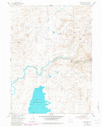
1955 Map of Dodge Ranch
USGS Topo · Published 1956About this map
Wheatland Reservoir No 2 dominates the southern landscape of this 1955 survey, its waters controlled by a Spillway and reaching northward through an intricate system of irrigation. The Laramie River winds across the center of the quadrangle, where water management is evident through the presence of a Gaging Station, a Flume, and the South Side Ditch. This era reflects a period when large ranching operations anchored the local economy and social structure in Albany County. Private landmarks such as the Kennedy Ranch, Palmer Ranch, and the North Albany Club serve as primary points of interest, while the Dodge Ranch is situated near the riverbanks. The terrain is marked by seasonal drainages like Duck Creek and Dodge Creek, as well as a utility Pipeline cutting across the northern sections, illustrating the intersection of natural water resources and mid-century infrastructure development.
Find a feature on this map
16 named features on this map. Tap any name to fly to it.
Don’t see what you’re looking for? This feature index may not catch every label — zoom into the map to look around manually.
Map Details
Editions of this 1955 Dodge Ranch Map
2 editions found
Other maps of this area

1954 · Torrington
USGS Topo · 1:250,000

1954 · Cheyenne
USGS Topo · 1:250,000

1955 · Mc Gill Lakes
USGS Topo · 1:24,000

1955 · Bluegrass Wells
USGS Topo · 1:24,000

1955 · Ayres Spring
USGS Topo · 1:24,000

1955 · Guide Rock
USGS Topo · 1:24,000

1955 · Bull Camp Peak
USGS Topo · 1:24,000

1958 · Cheyenne
USGS Topo · 1:250,000

1958 · Torrington
USGS Topo · 1:250,000

1968 · Davidson Flats
USGS Topo · 1:24,000