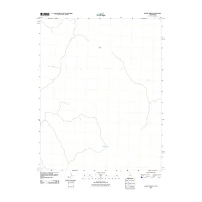
2011 Map of Dodge Spring
USGS Topo · Published 2011About this map
Halfway Camp and Dodge Spring anchor this high-desert landscape in Washington County, where the topography is defined by the winding course of Cedar Wash. The 2011 survey captures the area's sparse network of ranching or wayfinding landmarks, reflecting a remote corner of the Utah-Nevada borderlands. In the southern reach of the quadrangle, Bracken Pond serves as a notable water resource in an otherwise arid drainage system. The map provides a clear look at the relationship between seasonal watercourses and the established camps that rely on them, serving as a vital reference for understanding land use and resource management in this corner of the Great Basin.
Find a feature on this map
4 named features on this map. Tap any name to fly to it.
Don’t see what you’re looking for? This feature index may not catch every label — zoom into the map to look around manually.
Map Details
Editions of this 2011 Dodge Spring Map
This is the sole edition of this map. No revisions or reprints were ever made.
Other maps of this area

1885 · St. George
USGS Topo · 1:250,000

1885 · Pioche
USGS Topo · 1:250,000

1886 · Pioche
USGS Topo · 1:250,000

1891 · St. George
USGS Topo · 1:250,000

1953 · Cedar City
USGS Topo · 1:250,000

1954 · Caliente
USGS Topo · 1:250,000

1958 · Cedar City
USGS Topo · 1:250,000

1958 · Docs Pass
USGS Topo · 1:24,000

1959 · Caliente
USGS Topo · 1:250,000

1962 · Cedar City
USGS Topo · 1:250,000