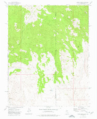
1973 Map of Dodge Spring
USGS Topo · Published 1977About this map
The rugged high-country boundary of southwest Utah and southeast Nevada is meticulously detailed in this early 1970s survey. The landscape is defined by its arid drainage network, where Cedar Wash, Beaver Dam Wash, and Bull Valley Wash carve through the terrain beneath East Bunker Peak and Upper Lima Mtn. Human presence in this isolated borderland is marked by the small settlement of Motoqua and the functional Halfway Camp, connected by a network of jeep trails that navigate the ridges and canyons.
Find a feature on this map
15 named features on this map. Tap any name to fly to it.
Don’t see what you’re looking for? This feature index may not catch every label — zoom into the map to look around manually.
Map Details
Editions of this 1973 Dodge Spring Map
This is the sole edition of this map. No revisions or reprints were ever made.
Other maps of this area

1885 · St. George
USGS Topo · 1:250,000

1885 · Pioche
USGS Topo · 1:250,000

1886 · Pioche
USGS Topo · 1:250,000

1891 · St. George
USGS Topo · 1:250,000

1953 · Cedar City
USGS Topo · 1:250,000

1954 · Caliente
USGS Topo · 1:250,000

1958 · Cedar City
USGS Topo · 1:250,000

1958 · Docs Pass
USGS Topo · 1:24,000

1959 · Caliente
USGS Topo · 1:250,000

1962 · Cedar City
USGS Topo · 1:250,000