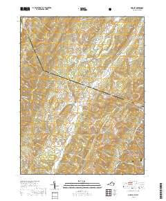
2019 Map of Doe Hill
USGS Topo · Published 2019About this map
Doe Hill and Sirons Mill serve as the primary focal points of this settlement pattern in the Virginia highlands, positioned where the Bullpasture River and Mill Run cut through the high ridges. The landscape is defined by the massive spine of Jack Mountain and the expansive George Washington National Forest, which blankets the eastern slopes. Evidence of early industry and community life is grounded in labels for Hiner Mill and the Totten Cem, while numerous water sources like Hiner Springs and Sanders Farm Spring indicate the importance of reliable hydrology in this mountainous terrain.
Find a feature on this map
70 named features on this map. Tap any name to fly to it.
Don’t see what you’re looking for? This feature index may not catch every label — zoom into the map to look around manually.
Map Details
Editions of this 2019 Doe Hill Map
This is the sole edition of this map. No revisions or reprints were ever made.
Other maps of this area

1889 · Beverly
USGS Topo · 1:125,000

1892 · Beverly
USGS Topo · 1:125,000

1892 · Franklin
USGS Topo · 1:125,000

1894 · Staunton
USGS Topo · 1:125,000

1896 · Franklin
USGS Topo · 1:125,000

1901 · Monterey
USGS Topo · 1:125,000

1922 · Spruce Knob
USGS Topo · 1:48,000

1922 · Circleville
USGS Topo · 1:62,500

1924 · Circleville
USGS Topo · 1:48,000

1924 · Mc Dowell
USGS Topo · 1:62,500