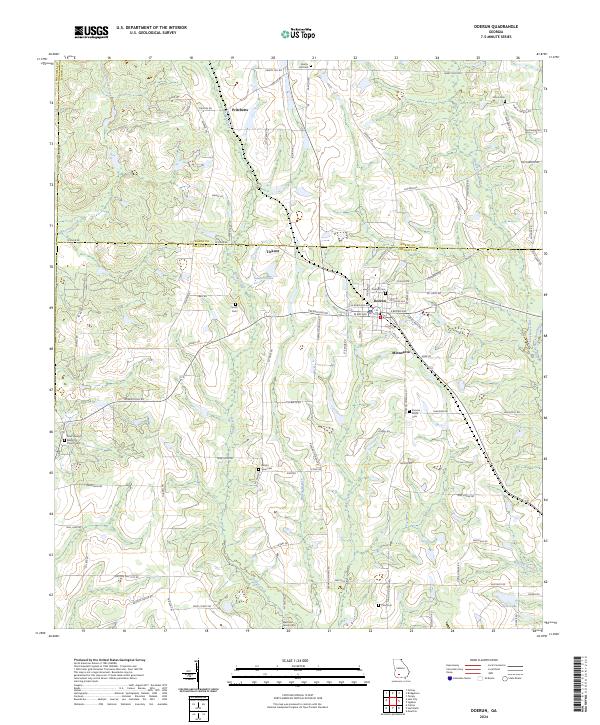
2024 Map of Doerun
USGS Topo · Published 2024About this map
Doerun serves as the central hub of this agricultural landscape in Southwest Georgia, situated where the borders of Worth and Colquitt counties meet. The settlement pattern is defined by a dense network of country roads like Old Albany Rd and Ticknor Rd, which connect outlying communities such as Ticknor and Minnesota to the town center. The rural character of the area is emphasized by its numerous family and community burial grounds, including the Marchant Family Cem and Duncan Smith Cem.
Find a feature on this map
90 named features on this map. Tap any name to fly to it.
Don’t see what you’re looking for? This feature index may not catch every label — zoom into the map to look around manually.
Map Details
Editions of this 2024 Doerun Map
This is the sole edition of this map. No revisions or reprints were ever made.
Other maps of this area

1953 · Dothan
USGS Topo · 1:250,000

1953 · Waycross
USGS Topo · 1:250,000

1954 · Dothan
USGS Topo · 1:250,000

1955 · Dothan
USGS Topo · 1:250,000

1956 · Baconton
USGS Topo · 1:62,500

1956 · Doerun
USGS Topo · 1:62,500

1958 · Waycross
USGS Topo · 1:250,000

1971 · Cotton
USGS Topo · 1:24,000
1974 · Putney
USGS Topo · 1:24,000
1974 · Doerun
USGS Topo · 1:24,000