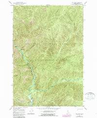
1966 Map of Dog Creek
USGS Topo · Published 1987About this map
The Selway River and the Middle Fork Clearwater River converge in this remote Idaho wilderness, where the landscape is defined by steep drainage basins and sharp elevation changes. Settled at the southern bend of the river, Selway Lodge serves as a lone human outpost, supported by a nearby Landing Strip and a network of primitive transportation. The geography is marked by river miles, specifically 143 Mile, 145 Mile, and 149 Mile, which act as vital reference points along the water's path.
Find a feature on this map
22 named features on this map. Tap any name to fly to it.
Don’t see what you’re looking for? This feature index may not catch every label — zoom into the map to look around manually.
Map Details
Editions of this 1966 Dog Creek Map
2 editions found

Other maps of this area

1911 · Lolo
USGS Topo · 1:250,000

1913 · Lolo
USGS Topo · 1:250,000

1956 · Elk City
USGS Topo · 1:250,000

1956 · Hamilton
USGS Topo · 1:250,000

1959 · Hamilton
USGS Topo · 1:250,000

1960 · Elk City
USGS Topo · 1:250,000

1960 · Hamilton
USGS Topo · 1:250,000

1964 · Hamilton
USGS Topo · 1:250,000

1966 · Twin Butte
USGS Topo · 1:24,000

1966 · Moose Ridge
USGS Topo · 1:24,000