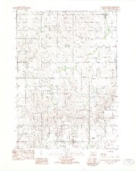
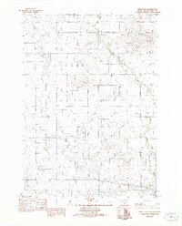
1982 Map of Dog Ear Buttes
USGS Topo · Published 1982About this map
Dog Ear Buttes and the surrounding rangeland of South Dakota's Tripp County are captured here just before the mid-1980s. The landscape is defined by the winding paths of Black Creek, Dog Ear Creek, and Mud Creek, which cut through the high plains. Human presence in this rural expanse is marked by the Weaver Sch and the section lines that organize the prairie into townships like Weaver, Dog Ear, and Mc Neely. The presence of a Gravel Pit near the southern border suggests the local material extraction necessary for maintaining the network of unimproved roads and trails that connected these remote homesteads and school districts. This 1982 provisional map reflects the area as it was field-checked in the late 1970s, preserving the placement of rural landmarks during a period of relative stability in the Great Plains agricultural economy.
Find a feature on this map
11 named features on this map. Tap any name to fly to it.
Don’t see what you’re looking for? This feature index may not catch every label — zoom into the map to look around manually.
Map Details
Editions of this 1982 Dog Ear Buttes Map
This is the sole edition of this map. No revisions or reprints were ever made.
Other maps of this area

1955 · Martin
USGS Topo · 1:250,000

1955 · Mitchell
USGS Topo · 1:250,000

1958 · Martin
USGS Topo · 1:250,000

1959 · Mitchell
USGS Topo · 1:250,000
1982 · Winner North
USGS Topo · 1:25,000
1982 · Witten SE
USGS Topo · 1:25,000

1982 · Witten
USGS Topo · 1:25,000
1982 · Winner South
USGS Topo · 1:25,000
1982 · Miller Hill
USGS Topo · 1:25,000
1982 · Wewela NE
USGS Topo · 1:24,000