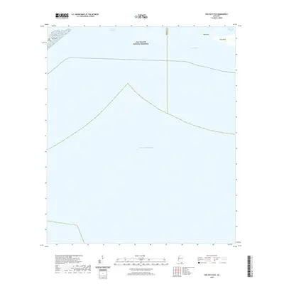
2020 Map of Dog Keys Pass
USGS Topo · Published 2020About this map
Gulf Islands National Seashore encompasses this section of the barrier islands, where the waters of the Mississippi Sound meet the open Gulf of Mexico. The map documents the shifting topography of the barrier chain, notably the eastern tip of Ship Island at East Point and the western reach of Horn Island at West Point. These islands are separated by the tidal inlets of Little Dog Keys Pass and the larger Dog Keys Pass. The boundary between Harrison and Jackson counties runs vertically through the pass, marking a political division in the middle of these coastal waters. This survey provides a precise record of the shoreline and shoals as they existed in the early 21st century, illustrating the gap between the major barrier islands and the navigable channels used for coastal transit.
Find a feature on this map
10 named features on this map. Tap any name to fly to it.
Don’t see what you’re looking for? This feature index may not catch every label — zoom into the map to look around manually.
Map Details
Editions of this 2020 Dog Keys Pass Map
This is the sole edition of this map. No revisions or reprints were ever made.
Other maps of this area

1941 · Horn Island
USGS Topo · 1:62,500

1942 · Horn Island
USGS Topo · 1:62,500

1943 · Pascagoula
USGS Topo · 1:62,500

1950 · Dog Keys Pass
USGS Topo · 1:24,000

1950 · Ship Island
USGS Topo · 1:24,000

1951 · Chandeleur Light
USGS Topo · 1:24,000

1953 · Mobile
USGS Topo · 1:250,000

1954 · Deer Island
USGS Topo · 1:24,000

1954 · Biloxi
USGS Topo · 1:62,500

1955 · Pascagoula
USGS Topo · 1:62,500