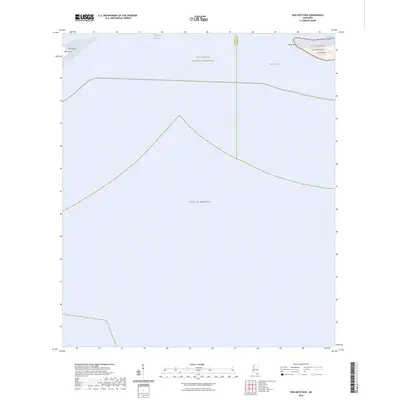
2024 Map of Dog Keys Pass
USGS Topo · Published 2024About this map
The Gulf Islands National Seashore defines this maritime landscape where the Mississippi Sound meets the open Gulf of Mexico. This coastal survey highlights the dynamic barrier island system off the Mississippi coast, specifically the eastern tip of Ship Island at East Point and the western reaches of Horn Island at West Point. These islands serve as critical buffers for the mainland, separated by the deep-water channels of Dog Keys Pass and the smaller Little Dog Keys Pass. Within the protected boundaries of the Gulf Islands Wilderness, the map documents the natural state of these shifting sands, showing no permanent human infrastructure, only the raw interface of land and sea that has historically guided mariners into Mississippi's harbors.
Find a feature on this map
11 named features on this map. Tap any name to fly to it.
Don’t see what you’re looking for? This feature index may not catch every label — zoom into the map to look around manually.
Map Details
Editions of this 2024 Dog Keys Pass Map
This is the sole edition of this map. No revisions or reprints were ever made.
Other maps of this area

1941 · Horn Island
USGS Topo · 1:62,500

1942 · Horn Island
USGS Topo · 1:62,500

1943 · Pascagoula
USGS Topo · 1:62,500

1950 · Dog Keys Pass
USGS Topo · 1:24,000

1950 · Ship Island
USGS Topo · 1:24,000

1951 · Chandeleur Light
USGS Topo · 1:24,000

1953 · Mobile
USGS Topo · 1:250,000

1954 · Deer Island
USGS Topo · 1:24,000

1954 · Biloxi
USGS Topo · 1:62,500

1955 · Pascagoula
USGS Topo · 1:62,500