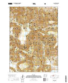
2020 Map of Dog Lake
USGS Topo · Published 2020About this map
Fremont National Forest defines the high-desert character of this Lake County landscape, where water sources are the primary markers of human and animal activity. Dog Lake serves as a central hydrological landmark, surrounded by a complex network of springs such as Telephone Spring, Hunter Spring, and White Spring that hint at the region's importance for range and wildlife management. The terrain is structured by high points like Dog Mtn and Castle Rock, with drainage systems like Dog Cr and Horseshoe Cr flowing through distinct depressions. In the northern reaches, the map captures the edge of the Drews Reservoir and remote sites such as Scotts Cabin Spring, suggesting early ranching or homesteading footprints. This modern survey provides an exact inventory of the named valleys, including Green Valley and Fall Valley, which have likely served as focal points for local land use for generations.
Find a feature on this map
53 named features on this map. Tap any name to fly to it.
Don’t see what you’re looking for? This feature index may not catch every label — zoom into the map to look around manually.
Map Details
Editions of this 2020 Dog Lake Map
This is the sole edition of this map. No revisions or reprints were ever made.
Other maps of this area

1886 · Alturas
USGS Topo · 1:250,000

1892 · Alturas
USGS Topo · 1:250,000

1954 · Alturas
USGS Topo · 1:250,000

1955 · Klamath Falls
USGS Topo · 1:250,000

1958 · Alturas
USGS Topo · 1:250,000

1958 · Klamath Falls
USGS Topo · 1:250,000

1960 · Strawberry Butte
USGS Topo · 1:62,500

1962 · Alturas
USGS Topo · 1:250,000

1962 · Steele Swamp
USGS Topo · 1:62,500

1962 · South Mountain
USGS Topo · 1:62,500