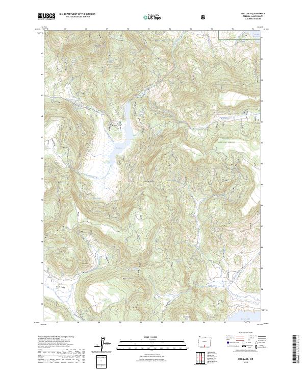
2023 Map of Dog Lake
USGS Topo · Published 2023About this map
Dog Lake and the high ridges of the Fremont National Forest characterize this high-desert landscape in Lake County. The map shows a complex network of springs and drainages, including Scotts Cabin Spring, Navy Spring, and Dog Lake Spring, which feed into major water bodies like Drews Reservoir in the northeast corner. This water-scarce environment is defined by its named valleys such as Yocum Valley and Young Valley, separated by prominent geological features like Dog Mtn and Castle Rock. The presence of the Main Trail S-H and routes through Buckaroo Pass reflect the area's legacy of range management and wilderness navigation. These detailed records of isolated springs and creek beds like McCoin Creek and Fall Creek provide essential data for understanding the historical hydrology of Oregon's high country.
Find a feature on this map
47 named features on this map. Tap any name to fly to it.
Don’t see what you’re looking for? This feature index may not catch every label — zoom into the map to look around manually.
Map Details
Editions of this 2023 Dog Lake Map
This is the sole edition of this map. No revisions or reprints were ever made.
Other maps of this area

1886 · Alturas
USGS Topo · 1:250,000

1892 · Alturas
USGS Topo · 1:250,000

1954 · Alturas
USGS Topo · 1:250,000

1955 · Klamath Falls
USGS Topo · 1:250,000

1958 · Alturas
USGS Topo · 1:250,000

1958 · Klamath Falls
USGS Topo · 1:250,000

1960 · Strawberry Butte
USGS Topo · 1:62,500

1962 · Alturas
USGS Topo · 1:250,000

1962 · Steele Swamp
USGS Topo · 1:62,500

1962 · South Mountain
USGS Topo · 1:62,500