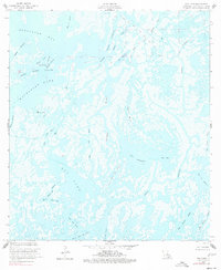
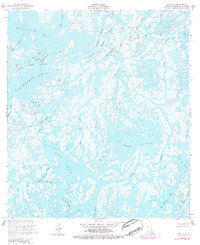
1953 Map of Dog Lake
USGS Topo · Published 1977About this map
The aquatic landscape of Terrebonne Parish dominates this mid-century survey, defined by a complex network of bayous, passes, and open lakes. At its heart lies the Dog Lake Oil and Gas Field, indicating the industrial reach of energy extraction into the coastal marshlands during the early 1950s. The map illustrates a world where water is the primary corridor, from the wide expanse of Dog Lake to the intricate channels of Quitman Bayou and Grand Caillou Bayou.
Find a feature on this map
32 named features on this map. Tap any name to fly to it.
Don’t see what you’re looking for? This feature index may not catch every label — zoom into the map to look around manually.
Map Details
Editions of this 1953 Dog Lake Map
5 editions found
Other maps of this area

1894 · Bayou De Large
USGS Topo · 1:62,500

1894 · Dulac
USGS Topo · 1:62,500

1935 · Cocodrie
USGS Topo · 1:31,680

1935 · Lake Mechant
USGS Topo · 1:31,680

1935 · Lake Quitman
USGS Topo · 1:31,680

1940 · Bayou Du Large
USGS Topo · 1:62,500

1941 · Bayou Du Large
USGS Topo · 1:62,500

1941 · Dulac
USGS Topo · 1:62,500
1944 · Dulac
USGS Topo · 1:62,500

1944 · Bayou Du Large
USGS Topo · 1:62,500