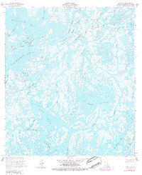
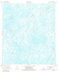
1953 Map of Dog Lake
USGS Topo · Published 1984About this map
Dog Lake and its surrounding marshlands define this coastal landscape in the mid-20th century, revealing an intricate network of Louisiana waterways and early petroleum development. The interplay between land and water is highlighted by the Dog Lake Oil Field and the Four Isle Bayou Oil and Gas Field, which signal the industrial footprint within the wetlands. Named features like China Island, Lake Becasse, and Hackberry Lake populate a terrain dominated by bayous, including the prominent Grand Caillou Bayou and Colyell Bayou. This area is noted for its subsidence, reflecting the evolving geomorphology of Terrebonne Parish. Navigational markers such as a Radio Tower and various passes, including Grand Pass des Ilettes and Pass des Ilettes, provide essential orientation through the complex deltaic environment.
Find a feature on this map
33 named features on this map. Tap any name to fly to it.
Don’t see what you’re looking for? This feature index may not catch every label — zoom into the map to look around manually.
Map Details
Editions of this 1953 Dog Lake Map
5 editions found
Other maps of this area

1894 · Bayou De Large
USGS Topo · 1:62,500

1894 · Dulac
USGS Topo · 1:62,500

1935 · Cocodrie
USGS Topo · 1:31,680

1935 · Lake Mechant
USGS Topo · 1:31,680

1935 · Lake Quitman
USGS Topo · 1:31,680

1940 · Bayou Du Large
USGS Topo · 1:62,500

1941 · Bayou Du Large
USGS Topo · 1:62,500

1941 · Dulac
USGS Topo · 1:62,500
1944 · Dulac
USGS Topo · 1:62,500

1944 · Bayou Du Large
USGS Topo · 1:62,500