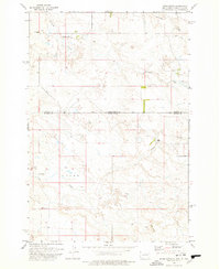
1978 Map of Dogie Butte
USGS Topo · Published 1978About this map
Mud Butte School and the Miller Ranch anchor this late-1970s topographic survey of the borderlands between North Dakota and South Dakota. The landscape is defined by the drainages of Sevenmile Creek, Fivemile Creek, and Firemile Creek, which carve through the high plains of Bowman and Harding Counties. This era of land use is marked by a mix of traditional ranching and emerging energy interests, evidenced by an Oil Well in the north and the presence of a remote Landing Strip and Jeep Trail. To the south, the terrain rises toward the namesake Dogie Butte, while the settlement area of Arnett sits near the headwaters of Arnett Creek. The map captures a transition in the western rangeland, where the expansive township grids of Union are interspersed with the infrastructure of modern resource extraction.
Find a feature on this map
14 named features on this map. Tap any name to fly to it.
Don’t see what you’re looking for? This feature index may not catch every label — zoom into the map to look around manually.
Map Details
Editions of this 1978 Dogie Butte Map
This is the sole edition of this map. No revisions or reprints were ever made.
Other maps of this area

1935 · Buffalo
USGS Topo · 1:125,000

1953 · Dickinson
USGS Topo · 1:250,000

1954 · Lemmon
USGS Topo · 1:250,000

1957 · Dickinson
USGS Topo · 1:250,000

1957 · Lemmon
USGS Topo · 1:250,000

1969 · Table Mountain
USGS Topo · 1:24,000

1969 · Ladner
USGS Topo · 1:24,000

1973 · Camel Butte
USGS Topo · 1:24,000
1973 · Mud Buttes
USGS Topo · 1:24,000
1973 · Cedar Ridge
USGS Topo · 1:24,000