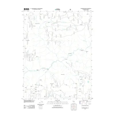
2012 Map of Dogwood Peak
USGS Topo · Published 2012About this map
Dogwood Peak towers over a landscape defined by the deep incisions of the Middle Fork Feather River and its numerous tributaries in this early 21st-century survey. The terrain is characterized by a series of prominent bars along the riverbanks, including Sherman Bar, Cleghorn Bar, and Butte Bar, which indicate the area's geological and likely historical mining significance. To the west, Franklin Hill and Hartman Bar Ridge flank Franklin Canyon, while Table Mountain provides a distinctive plateau to the south. The map documents an extensive network of Forest Service roads, such as 22n72 and 23n16, which provide access to remote points like Lookout Rock and the Cleghorn Bar Campground. Water sources are abundant throughout the high country, from the isolated Fowler Lake to smaller features like Deadman Spring and Bottle Springs.
Find a feature on this map
57 named features on this map. Tap any name to fly to it.
Don’t see what you’re looking for? This feature index may not catch every label — zoom into the map to look around manually.
Map Details
Editions of this 2012 Dogwood Peak Map
This is the sole edition of this map. No revisions or reprints were ever made.
Other maps of this area

1888 · Bidwell Bar
USGS Topo · 1:125,000

1891 · Bidwell Bar
USGS Topo · 1:125,000

1891 · Downieville
USGS Topo · 1:125,000

1893 · Bidwell Bar
USGS Topo · 1:125,000

1893 · Downieville
USGS Topo · 1:125,000

1895 · Bidwell Bar
USGS Topo · 1:125,000

1895 · Downieville
USGS Topo · 1:125,000

1896 · Downieville
USGS Topo · 1:125,000

1897 · Bidwell Bar
USGS Topo · 1:125,000

1897 · Downieville
USGS Topo · 1:125,000