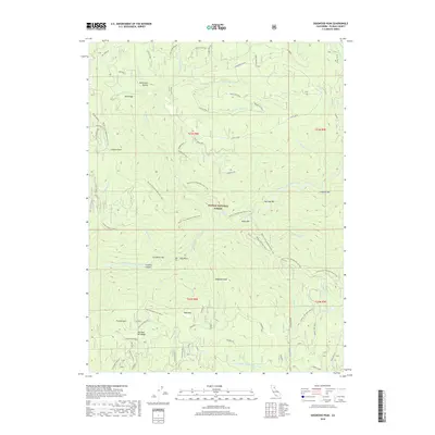
2018 Map of Dogwood Peak
USGS Topo · Published 2018About this map
Dogwood Peak dominates the central landscape of this Plumas County terrain, where the Middle Fork Feather River carves a deep path through the southern half of the sheet. The 2018 survey reveals a topography defined by significant elevation changes and river-level bars, including Sherman Bar, Butte Bar, and Carpenter Bar, which reflect the region's historic mining and riverfront activity. High points such as Lookout Rock, Table Mtn, and Franklin Hill surround the drainages of Slate Creek and Miller Fork. The Pacific Crest National Scenic Trail winds extensively through the Plumas National Forest, providing a modern corridor through a landscape still marked by family-named landmarks and old access points like McFarland Ravine and Cleghorn Bar. This map provides a detailed view of the intricate stream network, including Third Water Cr and Fourth Water Cr, as it appeared in the late 2010s.
Find a feature on this map
64 named features on this map. Tap any name to fly to it.
Don’t see what you’re looking for? This feature index may not catch every label — zoom into the map to look around manually.
Map Details
Editions of this 2018 Dogwood Peak Map
This is the sole edition of this map. No revisions or reprints were ever made.
Other maps of this area

1888 · Bidwell Bar
USGS Topo · 1:125,000

1891 · Bidwell Bar
USGS Topo · 1:125,000

1891 · Downieville
USGS Topo · 1:125,000

1893 · Bidwell Bar
USGS Topo · 1:125,000

1893 · Downieville
USGS Topo · 1:125,000

1895 · Bidwell Bar
USGS Topo · 1:125,000

1895 · Downieville
USGS Topo · 1:125,000

1896 · Downieville
USGS Topo · 1:125,000

1897 · Bidwell Bar
USGS Topo · 1:125,000

1897 · Downieville
USGS Topo · 1:125,000