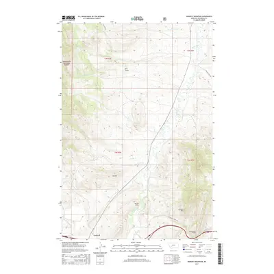
2017 Map of Doherty Mountain
USGS Topo · Published 2017About this map
The Boulder River carves through the heart of this Jefferson County landscape, winding south through the Boulder Valley toward the settlement of Cardwell. This 2017 topographic survey highlights the transition from the high, wooded slopes of the Deerlodge National Forest in the northwest to the complex network of drainage basins including Conrow Cr and Cottonwood Cr. The topography is dominated by prominent elevations such as Doherty Mtn and Red Hill, while the deeply incised Black Canyon and Cottonwood Canyon reveal the erosive power of the region's seasonal waterways. Regional transport is represented by local thoroughfares like Wilson Park Rd and Boulder Cutoff Rd, which follow the natural contours of the valley floors to connect outlying homesteads and range lands within the various township and range sections.
Find a feature on this map
19 named features on this map. Tap any name to fly to it.
Don’t see what you’re looking for? This feature index may not catch every label — zoom into the map to look around manually.
Map Details
Editions of this 2017 Doherty Mountain Map
This is the sole edition of this map. No revisions or reprints were ever made.
Other maps of this area

1886 · Fort Logan
USGS Topo · 1:250,000

1888 · Three Forks
USGS Topo · 1:250,000

1889 · Helena
USGS Topo · 1:250,000

1893 · Helena
USGS Topo · 1:250,000

1893 · Dillon
USGS Topo · 1:250,000

1894 · Three Forks
USGS Topo · 1:250,000

1895 · Three Forks
USGS Topo · 1:250,000

1899 · Boulder
USGS Topo · 1:125,000

1899 · Helena
USGS Topo · 1:250,000

1903 · Helena
USGS Topo · 1:250,000