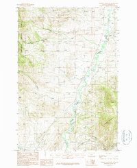
1987 Map of Doherty Mountain
USGS Topo · Published 1988About this map
The Boulder River winds through the heart of this Jefferson County landscape, serving as the primary drainage for a terrain defined by steep ridges and narrow drainages. To the west, the boundary of the Deerlodge National Forest encompasses high points like Sheep Rock and the South Black Canyon Fork of Cottonwood Creek. The map documents a sparsely populated but working landscape, where small-scale extractive activity is noted at Prospects and a Quarry near the riverbanks.
Find a feature on this map
14 named features on this map. Tap any name to fly to it.
Don’t see what you’re looking for? This feature index may not catch every label — zoom into the map to look around manually.
Map Details
Editions of this 1987 Doherty Mountain Map
This is the sole edition of this map. No revisions or reprints were ever made.
Other maps of this area

1886 · Fort Logan
USGS Topo · 1:250,000

1888 · Three Forks
USGS Topo · 1:250,000

1889 · Helena
USGS Topo · 1:250,000

1893 · Helena
USGS Topo · 1:250,000

1893 · Dillon
USGS Topo · 1:250,000

1894 · Three Forks
USGS Topo · 1:250,000

1895 · Three Forks
USGS Topo · 1:250,000

1899 · Boulder
USGS Topo · 1:125,000

1899 · Helena
USGS Topo · 1:250,000

1903 · Helena
USGS Topo · 1:250,000