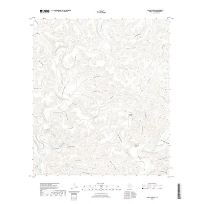
2019 Map of Dolan Springs
USGS Topo · Published 2019About this map
Dolan Falls and the surrounding river system define this arid Val Verde County landscape, where groundwater resources have shaped land use for generations. The map reveals a complex network of springs, including Jose Maria Spring, Blue Spring, and Snake Springs, which provide critical water points in an area dominated by deep drainage systems like Live Oak Canyon and Rough Spring Canyon. The intersection of the Devils River and the Dry Devils River creates a unique hydrological profile, marked by landforms such as Yellow Bluff and the circular Horseshoe Bend. Human activity is centered on ranching and private aviation, evidenced by the RNK Ranch Airport and the network of unpaved tracks like Dolan Creek Rd and the 12-mile Loop. This 2019 survey documents the enduring importance of named water sources like Spotted Oak Spring and Camp Spring in the Chihuahuan Desert borderlands.
Find a feature on this map
44 named features on this map. Tap any name to fly to it.
Don’t see what you’re looking for? This feature index may not catch every label — zoom into the map to look around manually.
Map Details
Editions of this 2019 Dolan Springs Map
This is the sole edition of this map. No revisions or reprints were ever made.
Other maps of this area

1944 · Dry Devil
USGS Topo · 1:62,500

1944 · Baker Crossing
USGS Topo · 1:62,500

1954 · Sonora
USGS Topo · 1:250,000

1958 · Sonora
USGS Topo · 1:250,000

1958 · Del Rio
USGS Topo · 1:250,000

1964 · Del Rio
USGS Topo · 1:250,000

1970 · Deaton Draw
USGS Topo · 1:24,000

1973 · Robinson Draw
USGS Topo · 1:24,000
1973 · White Draw
USGS Topo · 1:24,000
1978 · Open Hollow
USGS Topo · 1:24,000