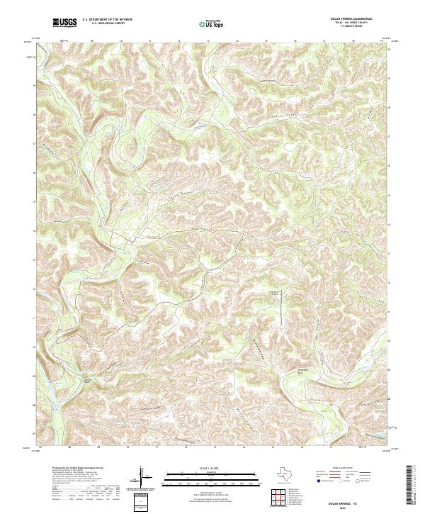
2022 Map of Dolan Springs
USGS Topo · Published 2022About this map
Dolan Springs and the surrounding canyonlands of Val Verde County are defined by a complex network of seasonal drainages and permanent water sources near the Devils River. The landscape is a maze of deep limestone cuts, featuring named topographical landmarks like Yellow Bluff and Horseshoe Bend. Transportation through this arid region is limited to primitive routes such as Dolan Creek Rd and the 12-Mile Loop Trl, which navigate the high ground between East Canyon and Rough Spring Canyon.
Find a feature on this map
41 named features on this map. Tap any name to fly to it.
Don’t see what you’re looking for? This feature index may not catch every label — zoom into the map to look around manually.
Map Details
Editions of this 2022 Dolan Springs Map
This is the sole edition of this map. No revisions or reprints were ever made.
Other maps of this area

1944 · Dry Devil
USGS Topo · 1:62,500

1944 · Baker Crossing
USGS Topo · 1:62,500

1954 · Sonora
USGS Topo · 1:250,000

1958 · Sonora
USGS Topo · 1:250,000

1958 · Del Rio
USGS Topo · 1:250,000

1964 · Del Rio
USGS Topo · 1:250,000

1970 · Deaton Draw
USGS Topo · 1:24,000

1973 · Robinson Draw
USGS Topo · 1:24,000
1973 · White Draw
USGS Topo · 1:24,000
1978 · Open Hollow
USGS Topo · 1:24,000