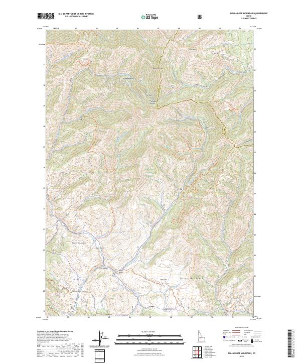
2023 Map of Dollarhide Mountain
USGS Topo · Published 2023About this map
Carrietown sits at the northern edge of this high-elevation landscape, where the Camas and Blaine County line bisects the Smoky Mountains. This area within the Sawtooth National Forest reflects a legacy of mineral exploration, evidenced by the presence of Rollins Placer and Rives Placer along the drainages of Little Smoky Creek. The terrain is defined by significant peaks like Dollarhide Mtn and Shaw Mtn, which separate the watersheds of Grindstone Creek and Carrie Creek. A complex network of backcountry routes, including the Carrie Creek Rd and the Dollarhide Jeep Trl, navigates the steep gulches and high passes like Dollarhide Summit. The map documents a landscape where primitive roads and trails provide the primary access to mountain features such as Ditto Flat and Trouble Canyon, illustrating the remote character of this part of central Idaho.
Find a feature on this map
58 named features on this map. Tap any name to fly to it.
Don’t see what you’re looking for? This feature index may not catch every label — zoom into the map to look around manually.
Map Details
Editions of this 2023 Dollarhide Mountain Map
This is the sole edition of this map. No revisions or reprints were ever made.
Other maps of this area

1900 · Sawtooth
USGS Topo · 1:125,000

1955 · Hailey
USGS Topo · 1:250,000

1957 · Fairfield
USGS Topo · 1:62,500

1957 · Blaine
USGS Topo · 1:62,500

1959 · Hailey
USGS Topo · 1:250,000

1962 · Hailey
USGS Topo · 1:250,000

1970 · Sydney Butte
USGS Topo · 1:24,000

1970 · Paradise Peak
USGS Topo · 1:24,000

1970 · Dollarhide Mtn
USGS Topo · 1:24,000
1970 · Baker Peak
USGS Topo · 1:24,000