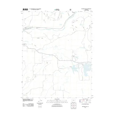
2011 Map of Dolores East
USGS Topo · Published 2011About this map
Dolores and the high terrain of Haycamp Mesa dominate this 2011 survey of the southwestern Colorado landscape. The Dolores River winds through the northwestern corner, passing the Dolores Forest Service Facility as it cuts between the mesa and Italian Canyon. This region is defined by an intricate network of water management, visible in the numerous reservoirs such as Stump Reservoir, Butler Reservoir, and the large Summit Reservoir. These catchments are connected by essential irrigation infrastructure like the Summit Ditch, Camp Ditch, and Highline Ditch, which support the agricultural life of the valley. To the south, the landscape is carved by Lost Canyon and Cash Canyon, while Sunset Memorial Gardens provides a point of local genealogical interest on the outskirts of town. Smaller settlements like Stapleton and various named points like Grouse Point further map the rural human footprint on the land.
Find a feature on this map
65 named features on this map. Tap any name to fly to it.
Don’t see what you’re looking for? This feature index may not catch every label — zoom into the map to look around manually.
Map Details
Editions of this 2011 Dolores East Map
This is the sole edition of this map. No revisions or reprints were ever made.
Other maps of this area

1956 · Cortez
USGS Topo · 1:250,000

1958 · Cortez
USGS Topo · 1:250,000

1959 · Cortez
USGS Topo · 1:250,000

1962 · Cortez
USGS Topo · 1:250,000

1963 · Stoner
USGS Topo · 1:24,000

1965 · Cortez
USGS Topo · 1:24,000

1965 · Dolores East
USGS Topo · 1:24,000

1965 · Dolores West
USGS Topo · 1:24,000
1965 · Millwood
USGS Topo · 1:24,000
1965 · Mancos
USGS Topo · 1:24,000