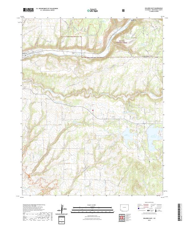
2022 Map of Dolores East
USGS Topo · Published 2022About this map
The Dolores River canyon and the surrounding highlands of Montezuma County are defined by a complex network of irrigation and water storage, essential for life in the high desert of southwest Colorado. Large-scale water management projects are evident through features like Summit Reservoir, Puett Reservoir, and Grimes Reservoir, which are linked by the Summit Ditch and Camp Ditch. These systems divert water from the river and Lost Canyon Cr to support the plateaus and mesas.
Find a feature on this map
86 named features on this map. Tap any name to fly to it.
Don’t see what you’re looking for? This feature index may not catch every label — zoom into the map to look around manually.
Map Details
Editions of this 2022 Dolores East Map
This is the sole edition of this map. No revisions or reprints were ever made.
Other maps of this area

1956 · Cortez
USGS Topo · 1:250,000

1958 · Cortez
USGS Topo · 1:250,000

1959 · Cortez
USGS Topo · 1:250,000

1962 · Cortez
USGS Topo · 1:250,000

1963 · Stoner
USGS Topo · 1:24,000

1965 · Cortez
USGS Topo · 1:24,000

1965 · Dolores East
USGS Topo · 1:24,000

1965 · Dolores West
USGS Topo · 1:24,000
1965 · Millwood
USGS Topo · 1:24,000
1965 · Mancos
USGS Topo · 1:24,000