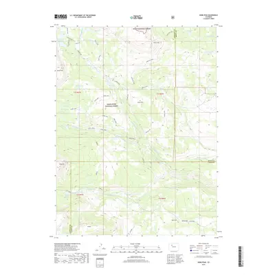
2019 Map of Dome Peak
USGS Topo · Published 2019About this map
Dome Peak stands as the prominent landmark within this high-elevation wilderness, situated at the intersection of the Routt National Forest and White River National Forest. This 2019 survey documents a landscape defined by an intricate network of alpine lakes and glacial basins, including Hooper Lake, Keener Lake, and the cluster of Island Lakes. The convergence of Garfield, Routt, and Eagle counties occurs amidst these peaks, where the headwaters of the Dry Fork Cabin Cr and various branches of Derby Cr begin their descent.
Find a feature on this map
59 named features on this map. Tap any name to fly to it.
Don’t see what you’re looking for? This feature index may not catch every label — zoom into the map to look around manually.
Map Details
Editions of this 2019 Dome Peak Map
This is the sole edition of this map. No revisions or reprints were ever made.
Other maps of this area

1927 · Glenwood Springs
USGS Topo · 1:125,000

1930 · Glenwood Springs
USGS Topo · 1:125,000

1954 · Craig
USGS Topo · 1:250,000

1957 · Craig
USGS Topo · 1:250,000

1957 · Leadville
USGS Topo · 1:250,000

1958 · Craig
USGS Topo · 1:250,000

1959 · Leadville
USGS Topo · 1:250,000

1960 · Leadville
USGS Topo · 1:250,000

1960 · Craig
USGS Topo · 1:250,000

1962 · Leadville
USGS Topo · 1:250,000