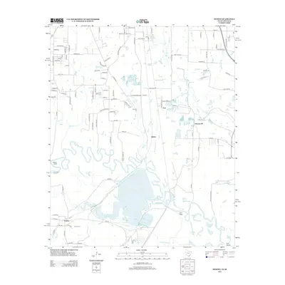
2013 Map of Domino
USGS Topo · Published 2013About this map
The Sulphur River carves a winding, serpentine path across this landscape, defining the character of the borderlands between Texas and Arkansas. The river’s ancient floodplain is marked by complex water features including Baker Slough, Long Slough, and Wilson Bend, creating a low-lying environment dominated by oxbow lakes and ridges such as Gum Ridge. The community of Domino sits at the southern edge of the map, accompanied by the Domino Cem, while the settlement of Hoot and the industrial Hoot Plant Rd reflect local activity north of the river.
Find a feature on this map
70 named features on this map. Tap any name to fly to it.
Don’t see what you’re looking for? This feature index may not catch every label — zoom into the map to look around manually.
Map Details
Editions of this 2013 Domino Map
This is the sole edition of this map. No revisions or reprints were ever made.
Other maps of this area

1907 · Atlanta
USGS Topo · 1:62,500

1909 · Texarkana
USGS Topo · 1:62,500

1910 · Atlanta
USGS Topo · 1:62,500

1952 · Mandeville
USGS Topo · 1:24,000

1952 · Doddridge NW
USGS Topo · 1:24,000

1952 · Fouke
USGS Topo · 1:24,000

1953 · Texarkana
USGS Topo · 1:250,000

1953 · El Dorado
USGS Topo · 1:250,000

1954 · Texarkana
USGS Topo · 1:24,000

1954 · Domino
USGS Topo · 1:24,000