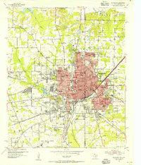
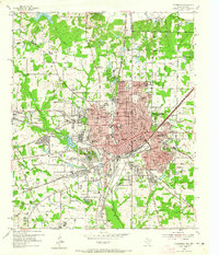
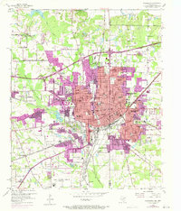
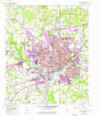
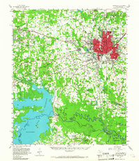
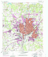
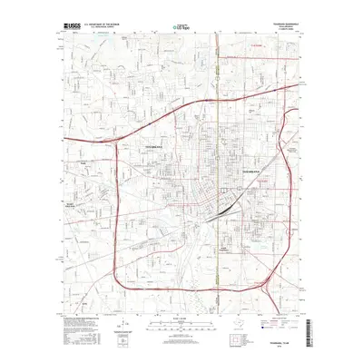
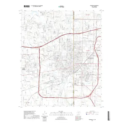
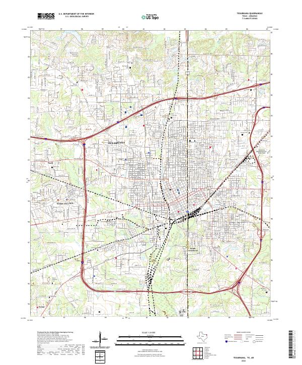
1954 Map of Texarkana
USGS Topo · Published 1955About this map
The border-straddling city of Texarkana is revealed in meticulous detail during the mid-1950s, showing the complex intersection of the Texas-Arkansas state line. This era captures the city as a major multi-state rail hub, where the tracks of the Kansas City Southern, Texas and Pacific, St Louis Southwestern, and Missouri Pacific converge. The urban landscape is dense with community infrastructure, from the St Louis Southwestern Railway Hospital to segregated education centers like Dunbar High Sch and Booker T Washington High Sch. Beyond the central grid, the map details the burgeoning suburbs of Nash and Wake Village, as well as the outlying Federal Correctional Institution. The presence of numerous neighborhood churches such as New Zion Ch and Hickory St Ch provides a granular look at the social geography of the twin cities during this postwar period.
Find a feature on this map
97 named features on this map. Tap any name to fly to it.
Don’t see what you’re looking for? This feature index may not catch every label — zoom into the map to look around manually.
Map Details
Editions of this 1954 Texarkana Map
6 editions found
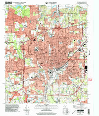
Historical Maps of Texarkana Through Time
13 maps found
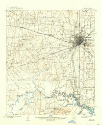
1909 Texarkana
Bowie County, TX
1953 Texarkana
Bowie County, TX
1954 Texarkana
Bowie County, TX
1954 Texarkana
Bowie County, TX

1956 Texarkana
Bowie County, TX

1986 Texarkana
Bowie County, TX

1992 Texarkana
Bowie County, TX
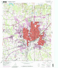
2001 Texarkana
Bowie County, TX
2011 Texarkana
Bowie County, TX
2013 Texarkana
Bowie County, TX
2016 Texarkana
Bowie County, TX
2019 Texarkana
Bowie County, TX
2022 Texarkana
Bowie County, TX