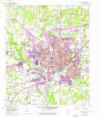
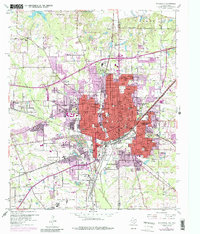
1954 Map of Texarkana
USGS Topo · Published 1976About this map
The border city of Texarkana straddles the Texas Arkansas line, acting as a massive rail hub during the mid-20th century. Five major railroads converge here, including the St Louis Southwestern and Missouri Pacific, reflecting the city's importance as a crossroads for the Piney Woods region. The 1950s layout shows a dense urban grid transitioning into postwar expansions, with purple revisions from the 1970s highlighting the growth of suburbs like Wake Village and South Texarkana.
Find a feature on this map
84 named features on this map. Tap any name to fly to it.
Don’t see what you’re looking for? This feature index may not catch every label — zoom into the map to look around manually.
Map Details
Editions of this 1954 Texarkana Map
6 editions found

Other maps of this area

1909 · Texarkana
USGS Topo · 1:62,500

1950 · Ogden
USGS Topo · 1:24,000

1950 · Barkman
USGS Topo · 1:24,000

1951 · Ogden
USGS Topo · 1:24,000

1951 · Barkman
USGS Topo · 1:24,000

1951 · Homan
USGS Topo · 1:24,000

1952 · Mandeville
USGS Topo · 1:24,000

1952 · Fouke
USGS Topo · 1:24,000

1953 · Texarkana
USGS Topo · 1:250,000

1953 · El Dorado
USGS Topo · 1:250,000